Houston_Downtown_Map.png
Size of this preview:
600 × 599 pixels
.
Other resolutions:
240 × 240 pixels
|
481 × 480 pixels
|
698 × 697 pixels
.
Summary
| Description |
English:
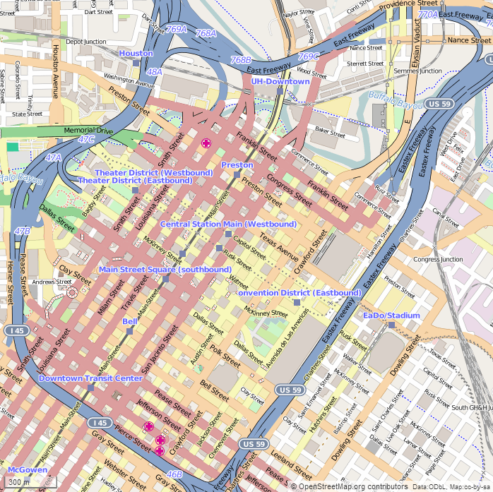
This map of
Downtown Houston
was created from OpenStreetMap project data, collected by the community. The image should remain clear of any additional edits. To annotate the map for an article, use the
Infobox
or
Location Map
template and reference the map using map module
Houston Downtown
. This map may be incomplete, and may contain errors. Submit corrections to the below source link. Do not rely solely on the map for navigation.
Steven Driskell
|
| Date | |
| Source | http://www.openstreetmap.org |
| Author | OpenStreetMap contributors |
Licensing
This file is licensed under the
Creative Commons
Attribution-Share Alike 2.5 Generic
license.
-
You are free:
- to share – to copy, distribute and transmit the work
- to remix – to adapt the work
-
Under the following conditions:
- attribution – You must give appropriate credit, provide a link to the license, and indicate if changes were made. You may do so in any reasonable manner, but not in any way that suggests the licensor endorses you or your use.
- share alike – If you remix, transform, or build upon the material, you must distribute your contributions under the same or compatible license as the original.