Horse_Heaven_Hills_AVA_map.JPG
No higher resolution available.
Summary
| Description |
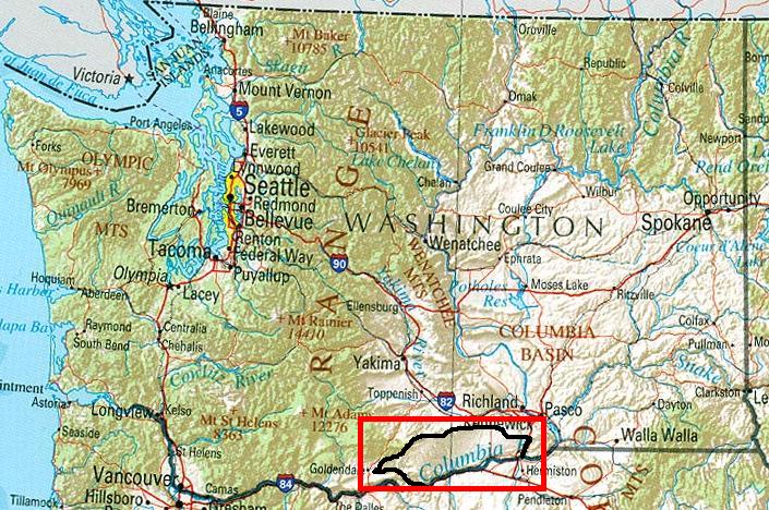
Modified map used to show the Horse Heaven Hills AVA within Washington State. Original public domain image locate at Perry-Castañeda Library Map Collection provided by U.S. Geological Survey 2001, printed 2002 Modified copied similarly released to public domain. |
| Source | |
| Author |
Licensing
|
|
This image is in the
public domain
in the United States because it only contains materials that originally came from the
United States Geological Survey
, an agency of the
United States Department of the Interior
. For more information, see
the official USGS copyright policy
.
|
|
Original upload log
The original description page was
here
. All following user names refer to en.wikipedia.
- 2007-06-15 03:08 Agne27 705×468×8 (128939 bytes) {{PD-USGov}} Modified map used to show the Columbia Valley AVA within Washington State. Original public domain image locate at [http://www.lib.utexas.edu/maps/us_2001/washington_ref_2001.jpg Perry-Castañeda Library Map Collection] provided by [http://www