Historicalcapitalsofchina_ancient.png
Size of this preview:
563 × 599 pixels
.
Other resolutions:
225 × 240 pixels
|
451 × 480 pixels
|
721 × 768 pixels
|
1,080 × 1,150 pixels
.
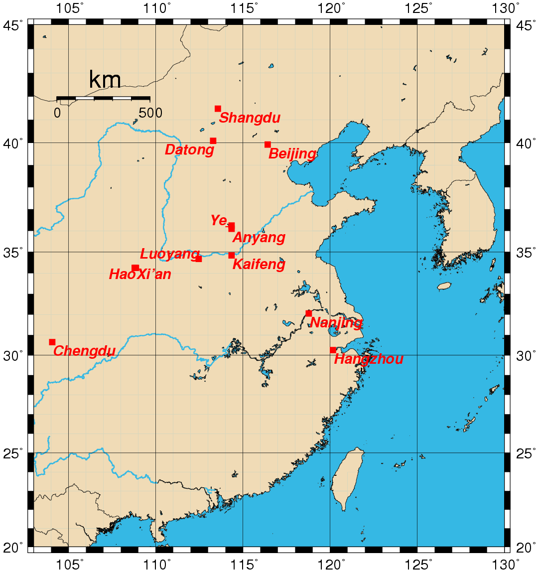
This image was copied from wikipedia:en. The original description was:
Map showing the location of the historical capitals of China in use prior to the 20th century . Map created by Rolf Müller using the Generic Mapping Tools (GMT).
Geographical coordinates (latitude, longitude) used:
- Anyang 36.1000 114.3500
- Beijing 39.9166 116.4166
- Chengdu 30.6500 104.0666
- Datong 40.0833 113.3000
- Hangzhou 30.2500 120.1666
- Hao 34.2500 108.8000
- Kaifeng 34.8500 114.3500
- Luoyang 34.6833 112.4666
- Nanjing 32.0500 118.7833
- Shangdu 41.4833 113.5666
- Xi'an 34.2500 108.8666
- Ye 36.2500 114.3500
External link

|
Permission is granted to copy, distribute and/or modify this document under the terms of the GNU Free Documentation License , Version 1.2 or any later version published by the Free Software Foundation ; with no Invariant Sections, no Front-Cover Texts, and no Back-Cover Texts. A copy of the license is included in the section entitled GNU Free Documentation License . |
|
|
This file is licensed under the Creative Commons Attribution-Share Alike 3.0 Unported license. | |
|
||
| This licensing tag was added to this file as part of the GFDL licensing update . |
| date/time | username | edit summary |
|---|---|---|
| 00:02, 25 August 2005 | Rolfmueller | (19th -> 20th century division) |
| 00:14, 24 August 2005 | Rolfmueller | (add links & coordinates) |
| 00:14, 24 August 2005 | Rolfmueller | (add links & coordinates) |
| 11:44, 23 August 2005 | Rolfmueller | (image information added) |
| 11:36, 23 August 2005 | Rolfmueller | (uploaded {{GFDL}}) |