High_Speed_Railroad_Map_of_the_United_States_2013.svg

Size of this PNG preview of this SVG file:
800 × 489 pixels
.
Other resolutions:
320 × 196 pixels
|
640 × 391 pixels
|
1,024 × 626 pixels
|
1,280 × 782 pixels
|
2,560 × 1,565 pixels
|
975 × 596 pixels
.
Summary

|
This file may be updated to reflect new information.
If you wish to use a specific version of the file without new updates being mirrored, please upload the required version as a separate file. |
| Description |
English
(en):
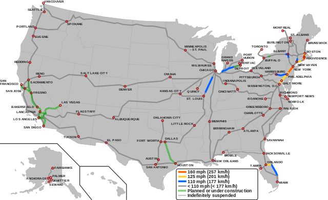
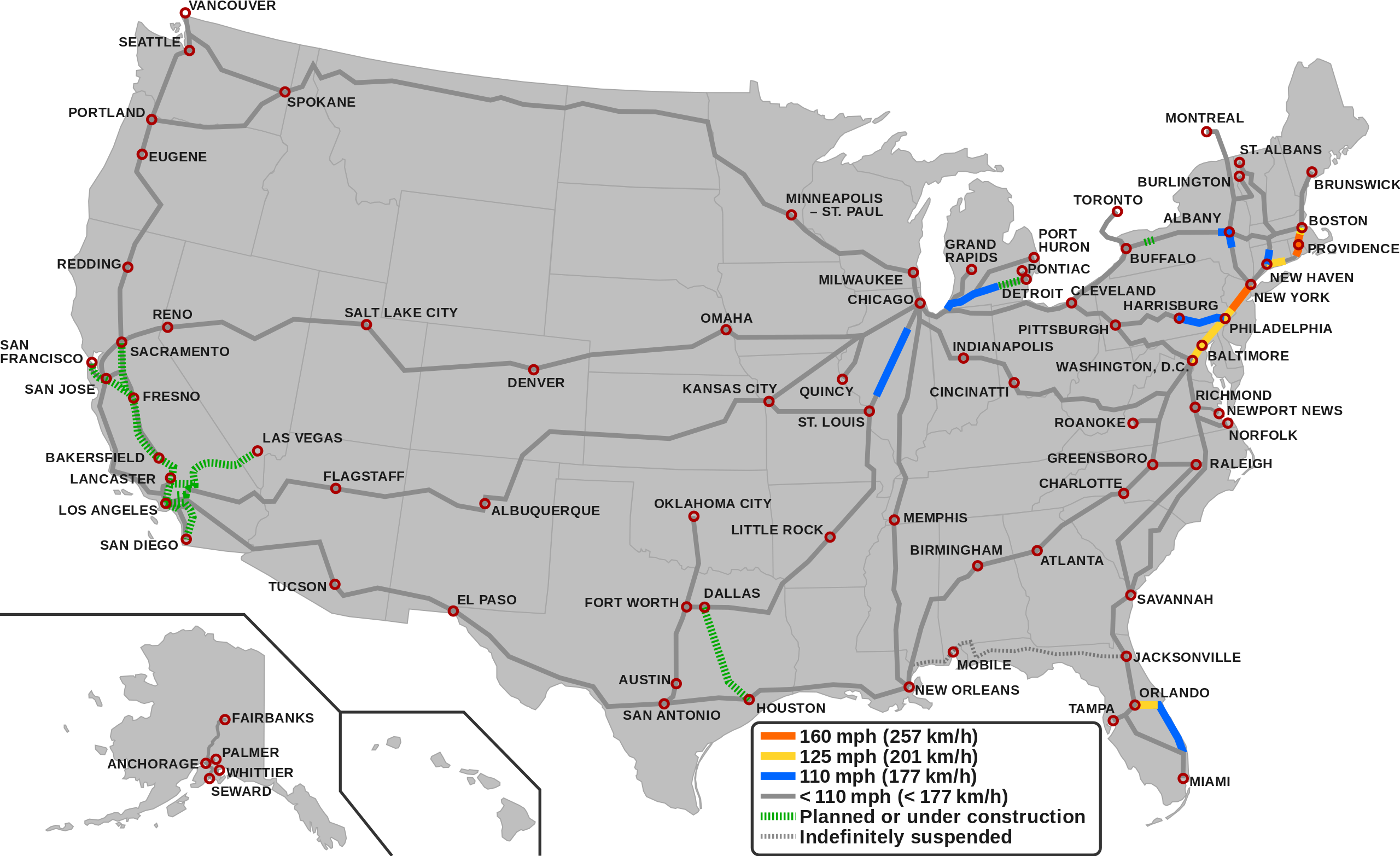
Map showing the high-speed rail network of the United States.
1
160 mph (257 km/h)
125 mph (201 km/h)
110 mph (177 km/h)
< 110 mph (< 177 Km/h)
Planned/Under construction
Indefinitely suspended
1
The map depicts the actual operational high-speed instead of the designed one which may be higher.
|
| Date | |
| Source |
|
| Author |
|
Licensing
This file is licensed under the
Creative Commons
Attribution-Share Alike 3.0 Unported
license.
-
You are free:
- to share – to copy, distribute and transmit the work
- to remix – to adapt the work
-
Under the following conditions:
- attribution – You must give appropriate credit, provide a link to the license, and indicate if changes were made. You may do so in any reasonable manner, but not in any way that suggests the licensor endorses you or your use.
- share alike – If you remix, transform, or build upon the material, you must distribute your contributions under the same or compatible license as the original.