Hatteras_Island_damage_by_Hurricane_Isabel.jpg

Size of this preview:
800 × 536 pixels
.
Other resolutions:
320 × 215 pixels
|
640 × 429 pixels
|
1,024 × 687 pixels
|
1,280 × 858 pixels
|
2,560 × 1,717 pixels
|
3,054 × 2,048 pixels
.
Summary
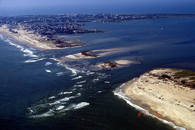
Hurricane Isabel breached one of the barrier islands in North Carolina http://coastal.er.usgs.gov/hurricanes/isabel/airphotos/medium/46_9_21_03_14.jpg http://coastal.er.usgs.gov/hurricanes/isabel/site-index.php?storm_id=4&site_id=12
| Object location |
|
View this and other nearby images on: OpenStreetMap |
|
|---|
Licensing
|
|
This image is in the
public domain
in the United States because it only contains materials that originally came from the
United States Geological Survey
, an agency of the
United States Department of the Interior
. For more information, see
the official USGS copyright policy
.
|
|