Gulf_Stream_water_temperature.jpg
No higher resolution available.
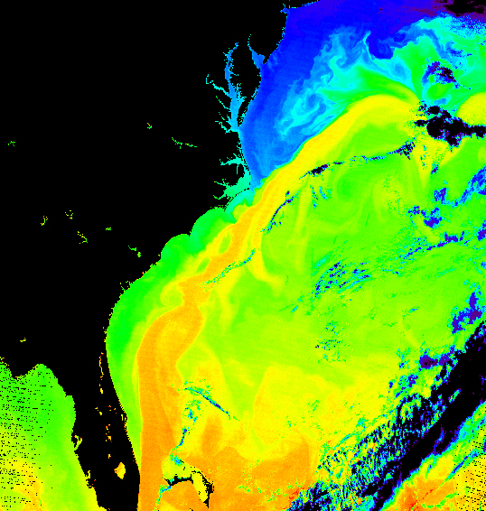
Summary
| Description |
Español:
Temperatura del agua en la Corriente del Golfo.
English:
False-color image of the temperature of the Gulf Stream
|
| Date | |
| Source | |
| Author | Donna Thomas/MODIS Ocean Group NASA/GSFC SST product by R. Evans et al. , U. Miami |
Licensing
|
|
This file is in the public domain in the United States because it was solely created by NASA . NASA copyright policy states that "NASA material is not protected by copyright unless noted ". (See Template:PD-USGov , NASA copyright policy page or JPL Image Use Policy .) |
|

|
Warnings:
|