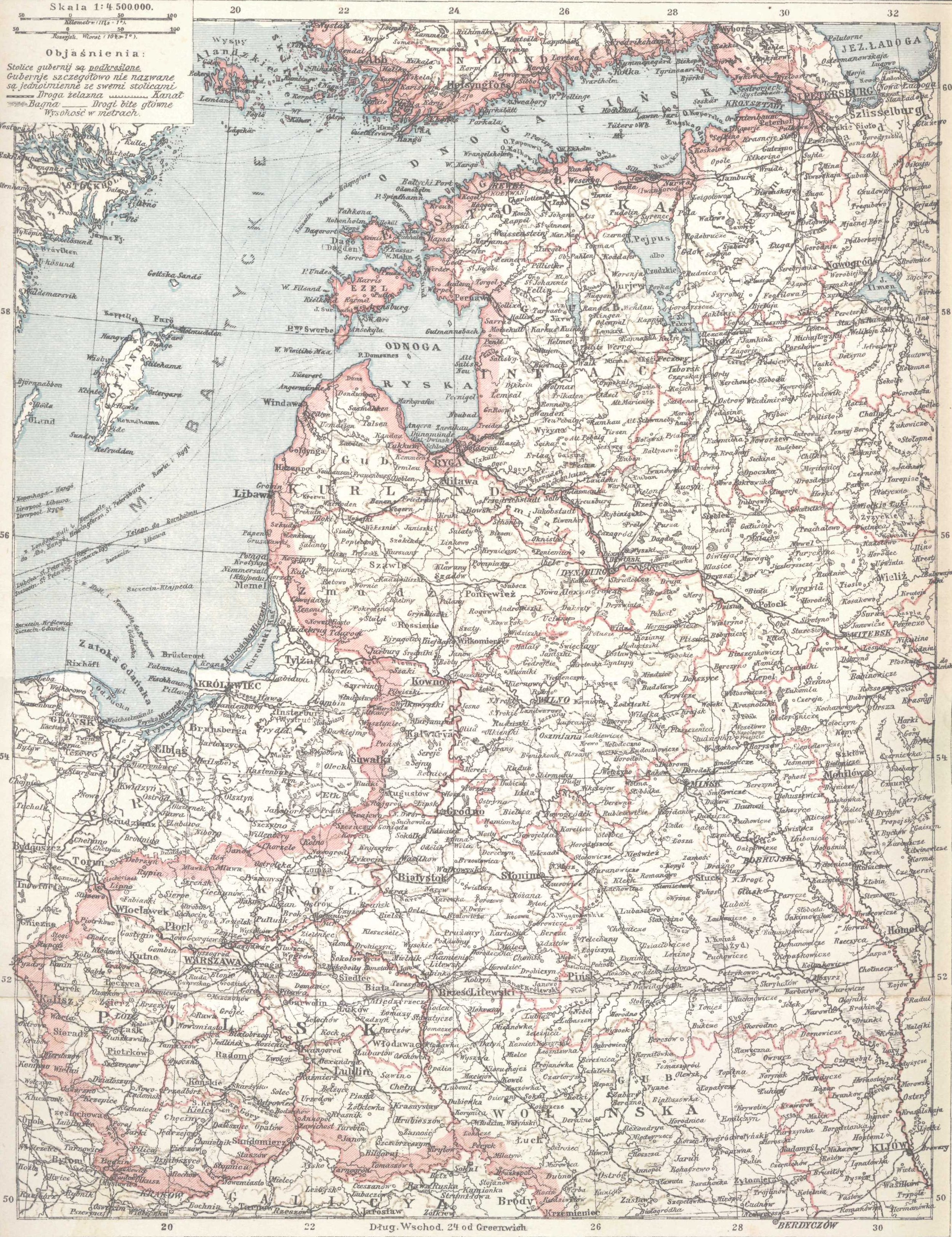
Gubernie_zachodnie_krolestwo_polskie_1902.jpg
Size of this preview:
461 × 599 pixels
.
Other resolutions:
185 × 240 pixels
|
369 × 480 pixels
|
591 × 768 pixels
|
788 × 1,024 pixels
|
2,500 × 3,247 pixels
.
Summary
| Description |
English:
Western Governorships of the Russian Empire and Polish Kingdom in 1902. Map from Olgebrand's Encyclopedia (lithography) printed in Warszawa, 1902
Polski:
Mapa "Gubernie Zachodnie i Królestwo Polskie" z encyklopedii Samuela Orgelbranda z r. 1902 - litografia
|
|||||||||
| Date | ||||||||||
| Source | pl:S._Orgelbranda_Encyklopedia_Powszechna_(1898) | |||||||||
| Geotemporal data | ||||||||||
| Date depicted | ||||||||||
| Map location | Western Governorships of the Russian Empire, Polish Kingdom | |||||||||
| Bounding box |
|
|||||||||
| Georeferencing | ||||||||||
| Bibliographic data | ||||||||||
| Language | Polish | |||||||||
Licensing
scanned by myself
|
source:
Samuel Orgelbrand's Universal Encyclopedia
with illustrations and maps
edited in sixteen volumes 1898–1904 (plus two volumes of "suplement", 1911 & 1912) |
|
|
This work is in the public domain in its country of origin and other countries and areas where the copyright term is the author's life plus 100 years or fewer . This work is in the public domain in the United States because it was published (or registered with the U.S. Copyright Office ) before January 1, 1929. |
| This file has been identified as being free of known restrictions under copyright law, including all related and neighboring rights. | |