Grandduchy_of_Hesse_HD_1812.png
Size of this preview:
432 × 599 pixels
.
Other resolutions:
173 × 240 pixels
|
346 × 480 pixels
|
671 × 931 pixels
.
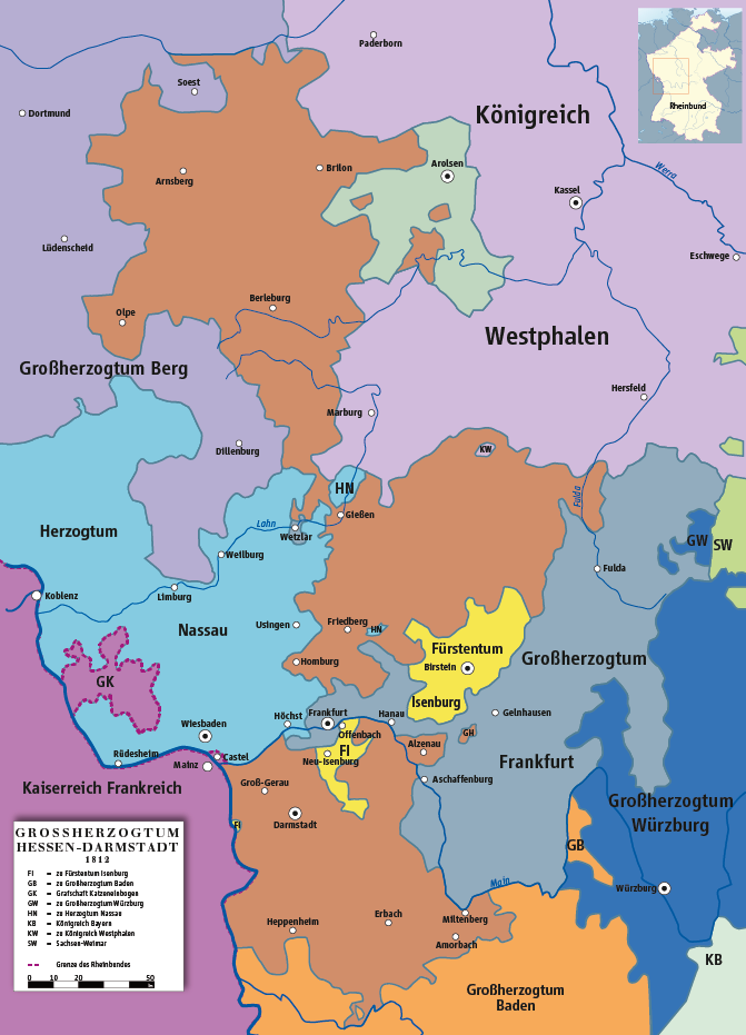
Summary
| Description |
Deutsch:
Karte des Großherzogtums Hessen 1812
English:
Map of Grand Duchy of Hesse 1812
|
||||||||
| Date | |||||||||
| Source | own drawing/Source of Information: Putzger – Historischer Weltatlas, 89. Auflage, 1965; Westermanns Großer Atlas zur Weltgeschichte, 1969; Haacks geographischer Atlas. VEB Hermann Haack Geographisch-Kartographische Anstalt, Gotha/Leipzig, 1. Auflage, 1979. | ||||||||
| Author | ziegelbrenner | ||||||||
|
Permission
( Reusing this file ) |
I, the copyright holder of this work, hereby publish it under the following licenses:
This file is licensed under the
Creative Commons
Attribution 2.5 Generic
license.
You may select the license of your choice.
|
