George_Bentel_House.jpg

Size of this preview:
800 × 600 pixels
.
Other resolutions:
320 × 240 pixels
|
640 × 480 pixels
|
1,024 × 768 pixels
|
1,280 × 960 pixels
|
2,560 × 1,920 pixels
|
2,816 × 2,112 pixels
.
|
|
This is an image of a place or building that is listed on the
National Register of Historic Places
in the
United States of America
. Its reference number is
84001224
.
|
| Camera location |
|
View this and other nearby images on: OpenStreetMap |
|
|---|
| Description |
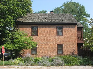
English:
Front of the
George Bentel House
, located on the northeastern corner of the junction of Granary and Brewery Streets in
New Harmony
,
Indiana
,
United States
. Built in 1823, it is listed on the
National Register of Historic Places
, and it is part of the
New Harmony Historic District
, a
National Historic Landmark District
.
|
||
| Date | Taken on 3 September 2011 | ||
| Source | Own work | ||
| Author | Nyttend | ||
|
Permission
( Reusing this file ) |
|