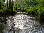
Geiselbach3.JPG

Size of this preview:
800 × 600 pixels
.
Other resolutions:
320 × 240 pixels
|
640 × 480 pixels
|
1,024 × 768 pixels
|
1,280 × 960 pixels
|
2,048 × 1,536 pixels
.
Summary
| Description Geiselbach3.JPG |
Deutsch:
Der Geiselbach im Teufelsgrund zwischen Mömbris und Geiselbach
|
| Date | |
| Source | Self-photographed |
| Author |
|
|
Location
InfoField
|
|
| Camera location |
50° 05′ 55.48″ N, 9° 09′ 22.85″ E
|
View this and other nearby images on: OpenStreetMap |
|
|---|
|
Licensing
| Public domain Public domain false false |
|
|
This work has been released into the
public domain
by its author,
Freak-Line-Community
at
German Wikipedia
. This applies worldwide.
In some countries this may not be legally possible; if so: Freak-Line-Community grants anyone the right to use this work for any purpose , without any conditions, unless such conditions are required by law. Public domain Public domain false false |
Uploadlog of prior de:Datei:Geiselbach3.JPG :
- 2009-05-25 18:42:29, 2.048×1.536 (1,16 MB), de:User:Freak-Line-Community , ({{Information |Beschreibung = Der Geiselbach im Teufelsgrund |Quelle = selbst fotografiert |Urheber = Freak-Line-Community |Datum = |Genehmigung = |Andere Versionen = |Anmerkungen = }})
Captions
Add a one-line explanation of what this file represents


