Gangius_-_Turku_1634_1.jpg
Size of this preview:
607 × 599 pixels
.
Other resolutions:
243 × 240 pixels
|
486 × 480 pixels
|
778 × 768 pixels
|
1,037 × 1,024 pixels
|
2,074 × 2,048 pixels
|
7,782 × 7,683 pixels
.
Summary
| Title |
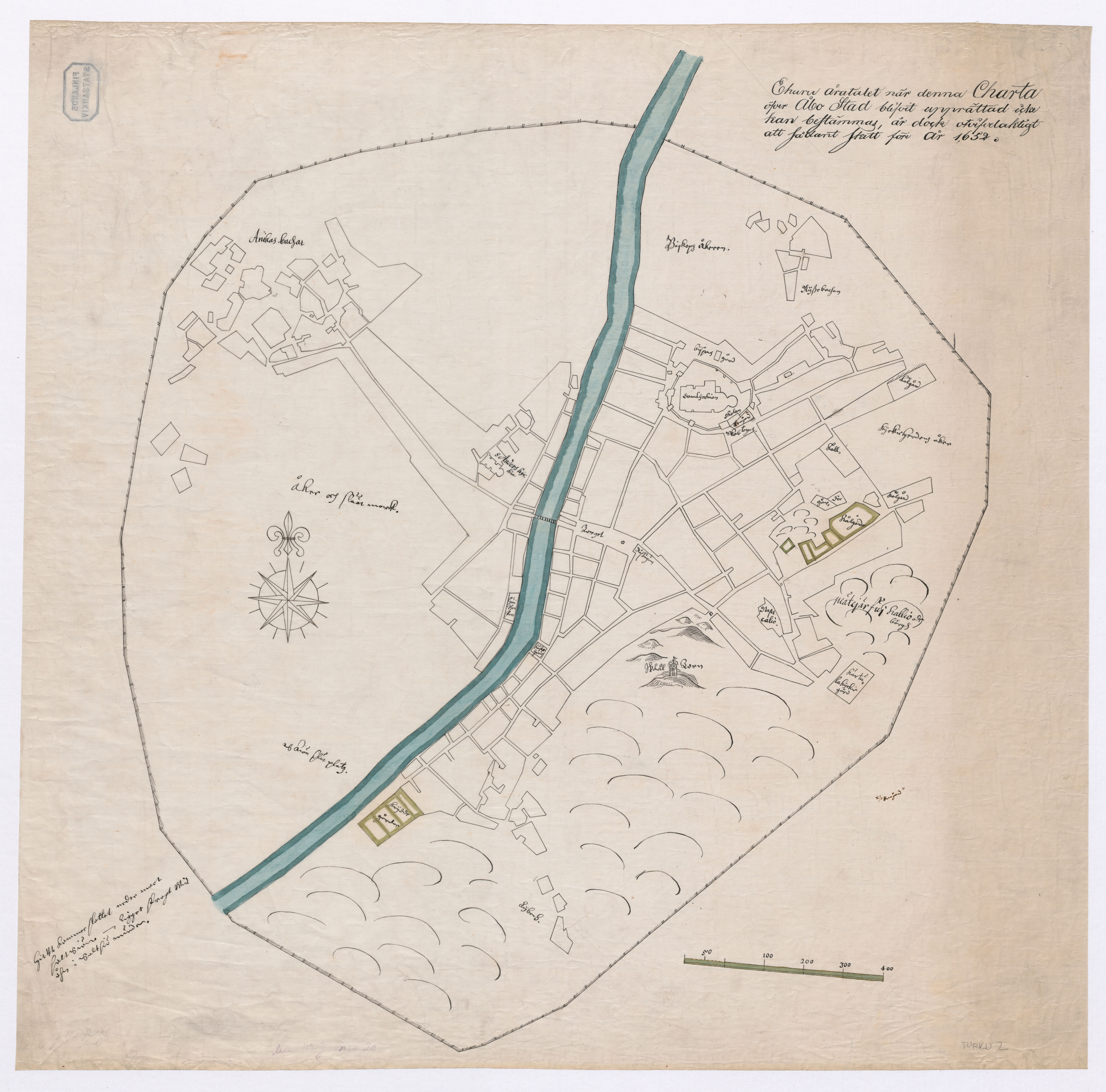
Redrawn Olof Gangius map from 1634 II
|
|||||||||||||||||||||||
| Description |
Suomi:
Kartan laatimisajankohtaa ei ole voitu määritellä, joten todennäköisesti se on tapahtunut ennen vuotta 1652
Svenska:
Ehuru åratalet när denna Charta öfver Åbo Stad blifvit upprättad icke har bestämmas, är dock otvifvelaktigt att sådant skett före år 1652.
English:
The map date is probably before 1652.
|
|||||||||||||||||||||||
| Date | ||||||||||||||||||||||||
| Source |
|
|||||||||||||||||||||||
| Creator | ||||||||||||||||||||||||
|
Permission
( Reusing this file ) |
|
|||||||||||||||||||||||
| Geotemporal data | ||||||||||||||||||||||||
| Date depicted | ||||||||||||||||||||||||
| Map location | Turku (Q38511) | |||||||||||||||||||||||
| Georeferencing | If inappropriate please set warp_status = skip to hide. | |||||||||||||||||||||||
| Bibliographic data | ||||||||||||||||||||||||
| Language | Swedish | |||||||||||||||||||||||
| Publisher |
Öfverstyrelsen för Landtmäteriet
|
|||||||||||||||||||||||
| Archival data | ||||||||||||||||||||||||
| Collection |
|
|||||||||||||||||||||||
| Accession number | ||||||||||||||||||||||||
| Dimensions | 1 × 1 cm (0.3 × 0.3 in) | |||||||||||||||||||||||

