Frisian_kingdom.gif
Size of this preview:
640 × 599 pixels
.
Other resolutions:
256 × 240 pixels
|
945 × 885 pixels
.
Summary
| Description |
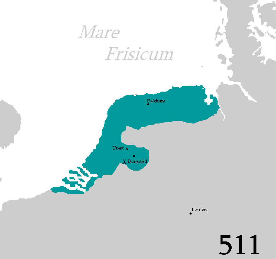
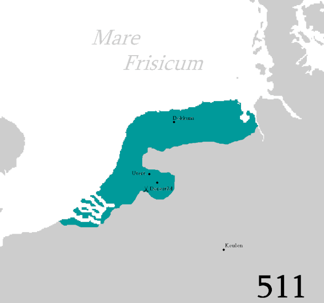
Frysk:
Kaart fan it Fryske keningryk yn de 6e, 7e en 8e ieu.
English:
Map of the Frisian kingdom in the 6th, 7th and 8th century.
Русский:
Карта Фризского королевства в 6, 7 и 8 веке.
|
| Date | |
| Source | Own work |
| Author | Blautosk |
Licensing
|
|
I, the copyright holder of this work, release this work into the
public domain
. This applies worldwide.
In some countries this may not be legally possible; if so: I grant anyone the right to use this work for any purpose , without any conditions, unless such conditions are required by law. |