Franklingulfstream.jpg
Size of this preview:
736 × 599 pixels
.
Other resolutions:
295 × 240 pixels
|
590 × 480 pixels
|
943 × 768 pixels
|
1,258 × 1,024 pixels
|
2,516 × 2,048 pixels
|
3,089 × 2,515 pixels
.
| Description |
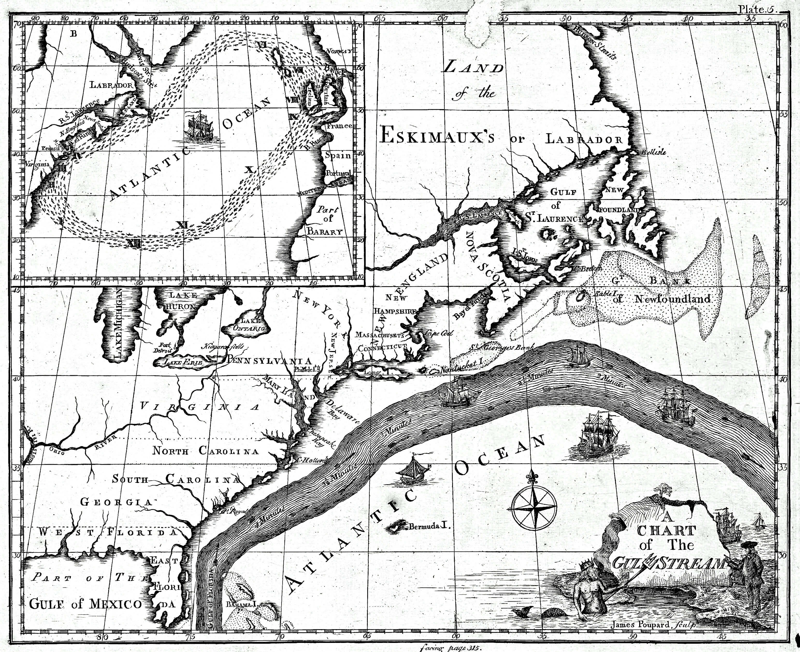
English:
Earliest known map of the Gulf Stream
|
| Date | |
| Source |
https://www.loc.gov/resource/g9112g.ct000136/
(2018-03-20)
|
| Author | Library of Congress/Benjamin Franklin |
| Other versions |
Cropped version uploaded in September 2016:

|
Licensing
|
|
This image is in the
public domain
because it contains materials that originally came from the U.S.
National Oceanic and Atmospheric Administration
, taken or made as part of an employee's official duties.
|
|
Original upload log
The original description page was
here
. All following user names refer to en.wikipedia.
- 2008-09-21 12:47 Thegreatdr 540×433× (79994 bytes) {{Information |Description=Earliest known map of the Gulf Stream |Source=http://oceanexplorer.noaa.gov/library/readings/hires/gulf_stream_map.jpg |Date=2008-09-21 |Author=Library of Congress/Benjamin Franklin |Permission= |other_versions= }}