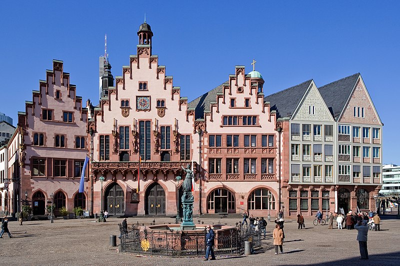
Frankfurt_Am_Main-Roemerberg_19-27_von_Suedosten-20110307.jpg

Summary
| Description Frankfurt Am Main-Roemerberg 19-27 von Suedosten-20110307.jpg |
English:
Frankfurt on the Main:
Roemerberg
19–27 as seen from the Roemerberg from southeast
Deutsch:
Frankfurt am Main:
Römerberg
19–27, vom Römerberg von Südosten gesehen
|
| Date | |
| Source | Own work |
| Author | Mylius |
| Camera location |
50° 06′ 37.29″ N, 8° 40′ 56.47″ E
|
View this and other nearby images on: OpenStreetMap |
|
|---|
Licensing
|
English:
I,
Roland Meinecke
(
Roland Meinecke
) am the creator of this work and I hereby publish it under the licences detailed below.
You may use this work free of charge under two conditions: Naming the image's author and inheritance of the chosen license. If you want to learn more details about the usage of this work, please visit my userpage .
Deutsch:
Ich,
Roland Meinecke
(
Roland Meinecke
) bin der Autor dieses Bildwerkes, und ich veröffentliche es hiermit unter den unten beschriebenen Lizenzen.
Sie dürfen dieses Bild unter folgenden Bedingungen kostenlos nutzen: Namensangabe des Bildautors und Weitervererbung der gewählten Lizenz. Bitte schauen Sie auf meine Benutzerseite , wenn Sie Einzelheiten über die Nutzung dieses Bildwerkes erfahren wollen. |
||||||||||
|

|
This image has been assessed using the
Quality image guidelines
and is considered a
Quality image
.
العربية ∙ جازايرية ∙ беларуская ∙ беларуская (тарашкевіца) ∙ български ∙ বাংলা ∙ català ∙ čeština ∙ Cymraeg ∙ Deutsch ∙ Schweizer Hochdeutsch ∙ Zazaki ∙ Ελληνικά ∙ English ∙ Esperanto ∙ español ∙ eesti ∙ euskara ∙ فارسی ∙ suomi ∙ français ∙ galego ∙ עברית ∙ हिन्दी ∙ hrvatski ∙ magyar ∙ հայերեն ∙ Bahasa Indonesia ∙ italiano ∙ 日本語 ∙ Jawa ∙ ქართული ∙ 한국어 ∙ kurdî ∙ Lëtzebuergesch ∙ lietuvių ∙ македонски ∙ മലയാളം ∙ मराठी ∙ Bahasa Melayu ∙ Nederlands ∙ Norfuk / Pitkern ∙ polski ∙ português ∙ português do Brasil ∙ rumantsch ∙ română ∙ русский ∙ sicilianu ∙ slovenčina ∙ slovenščina ∙ shqip ∙ српски / srpski ∙ svenska ∙ தமிழ் ∙ తెలుగు ∙ ไทย ∙ Tagalog ∙ Türkçe ∙ toki pona ∙ українська ∙ vèneto ∙ Tiếng Việt ∙ 中文 ∙ 中文(简体) ∙ 中文(繁體) ∙ +/− |

