France_map_Lambert-93_with_regions_and_departments-occupation.svg

Size of this PNG preview of this SVG file:
632 × 600 pixels
.
Other resolutions:
253 × 240 pixels
|
506 × 480 pixels
|
809 × 768 pixels
|
1,079 × 1,024 pixels
|
2,158 × 2,048 pixels
|
1,996 × 1,894 pixels
.
Summary
| Description |
English:
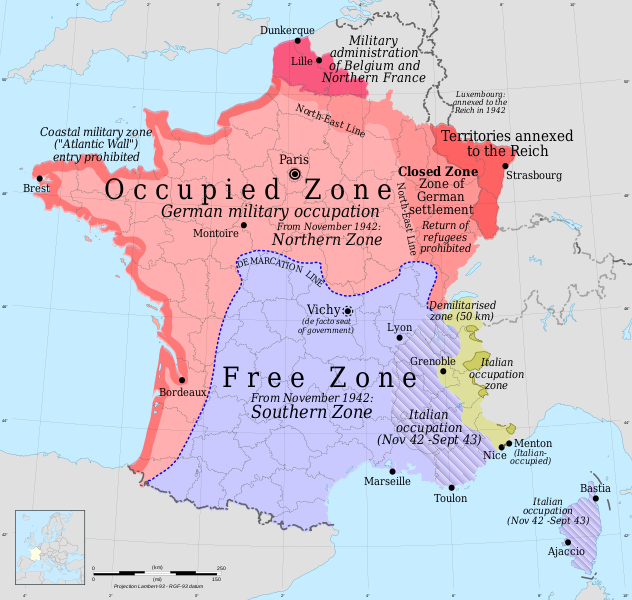
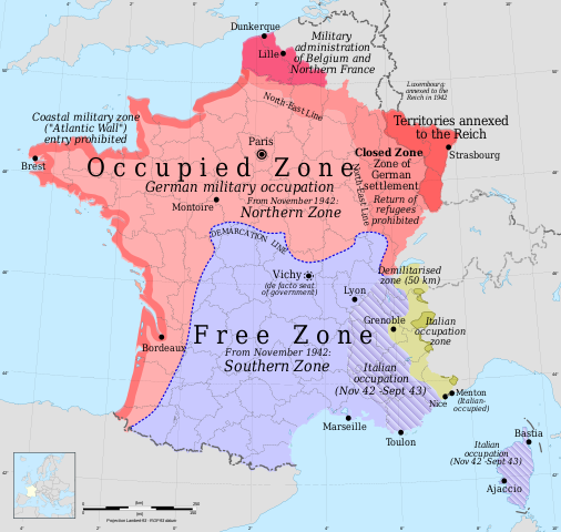
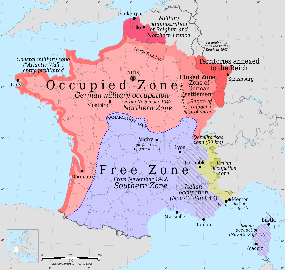
Occupation zones of France during the Second World War - English version
Français :
Carte de France : les zones françaises occupées pendant la Seconde Guerre mondiale, version anglaise
|
| Date | |
| Source |
Own work
|
| Author | Rama for zones |
|
Permission
( Reusing this file ) |
GFDL / Attribution and Share-Alike required |
| Other versions |
versions
|


Licensing
I, the copyright holder of this work, hereby publish it under the following licenses:

|
Permission is granted to copy, distribute and/or modify this document under the terms of the GNU Free Documentation License , Version 1.2 or any later version published by the Free Software Foundation ; with no Invariant Sections, no Front-Cover Texts, and no Back-Cover Texts. A copy of the license is included in the section entitled GNU Free Documentation License . |
This file is licensed under the
Creative Commons
Attribution-Share Alike
4.0 International
,
3.0 Unported
,
2.5 Generic
,
2.0 Generic
and
1.0 Generic
license.
-
You are free:
- to share – to copy, distribute and transmit the work
- to remix – to adapt the work
-
Under the following conditions:
- attribution – You must give appropriate credit, provide a link to the license, and indicate if changes were made. You may do so in any reasonable manner, but not in any way that suggests the licensor endorses you or your use.
- share alike – If you remix, transform, or build upon the material, you must distribute your contributions under the same or compatible license as the original.
You may select the license of your choice.