France_1800.png

Size of this preview:
599 × 599 pixels
.
Other resolutions:
240 × 240 pixels
|
480 × 480 pixels
|
768 × 768 pixels
|
1,023 × 1,024 pixels
|
1,795 × 1,796 pixels
.
Summary
| Description |
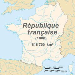
English:
Map of France in 1800
Français :
Carte de la première république française en 1800
|
| Date | |
| Source | Euratlas - Carte historique de l'Europe en l'an 1800 |
| Author | European citizen |
|
Permission
( Reusing this file ) |
domaine public |
Licensing
|
|
I, the copyright holder of this work, release this work into the
public domain
. This applies worldwide.
In some countries this may not be legally possible; if so: I grant anyone the right to use this work for any purpose , without any conditions, unless such conditions are required by law. |