Fort_Bragg_California_aerial_view.jpg
Size of this preview:
800 × 533 pixels
.
Other resolutions:
320 × 213 pixels
|
640 × 427 pixels
|
1,024 × 683 pixels
|
1,500 × 1,000 pixels
.
| Description |
English:
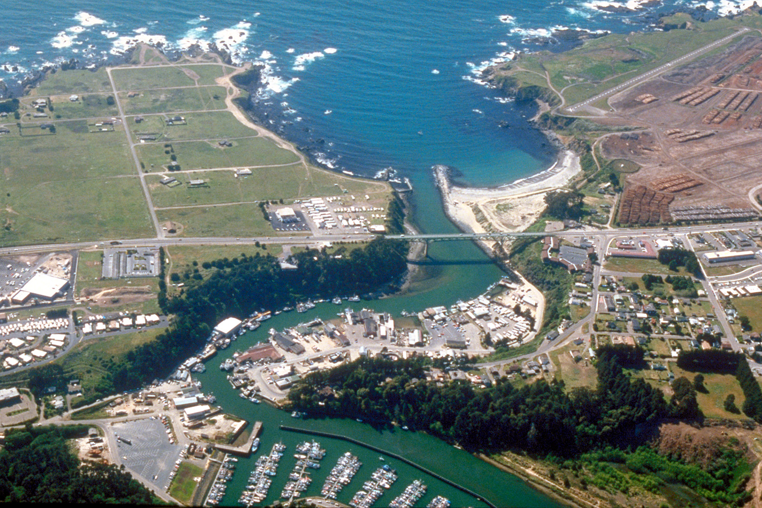
Aerial view of the mouth of the Noyo River on the Pacific Ocean at Fort Bragg, Mendocino County, California, USA. California State Route 1 (Main Street in Fort Bragg) crosses the river at the outlet. View is to the west.
Coordinates:
39°25′38.37″N
123°48′24.63″W
/
39.427325°N 123.8068417°W
|
||
| Date | not specified or unknown, 2007 or before, but judging by the view and visual of the photo, it appears to be from the mid-late 1990s. | ||
| Source |
U.S. Army Corps of Engineers Digital Visual Library
Image page Image description page Digital Visual Library home page |
||
| Author | Robert Campbell | ||
|
Permission
( Reusing this file ) |
This file is licensed under the
Creative Commons
Attribution-Share Alike 3.0 Unported
license.
|
||
| Location | Fort Bragg, Mendocino County, California, USA |

| Camera location |
|
View this and other nearby images on: OpenStreetMap |
|
|---|