FortPemberton.jpg
Size of this preview:
800 × 589 pixels
.
Other resolutions:
320 × 235 pixels
|
640 × 471 pixels
|
1,024 × 753 pixels
|
1,280 × 942 pixels
|
2,560 × 1,883 pixels
|
5,653 × 4,159 pixels
.
Summary
| Description |
English:
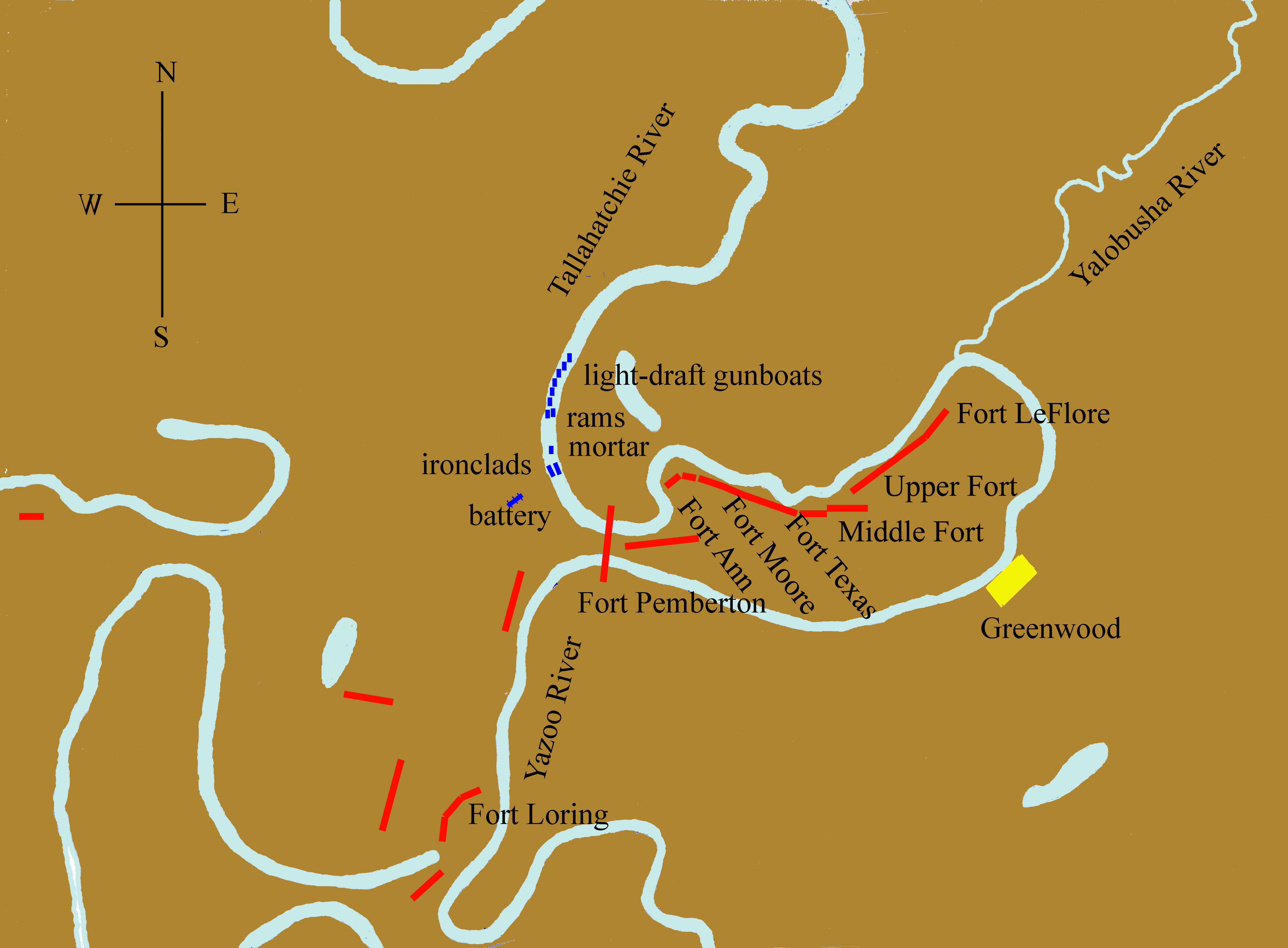
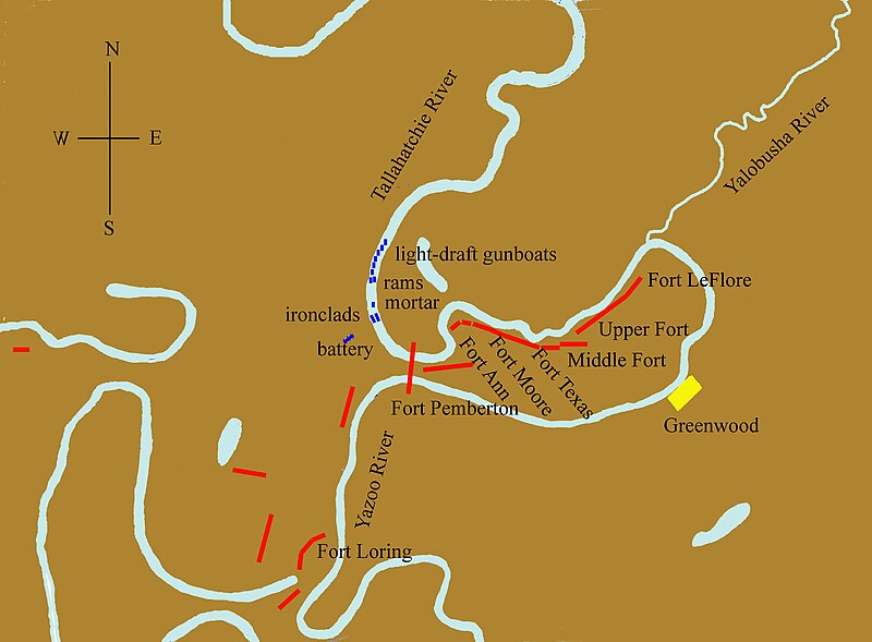
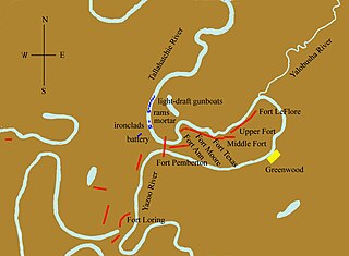
Opposing forces near Greenwood, Mississippi, in the Yazoo Pass Expedition of the American Civil War (March 1863).
|
| Date | |
| Source | Own work |
| Author | Kloeppel |
|
Permission
( Reusing this file ) |
Own work |
This map is derived from maps prepared by or for the US Government: one for B.Gen. W. W. Loring (CSA) ( Official military atlas, Plate 67/2); the other for Lt.Col. J. H. Wilson (USA) ( Official records (Army) , ser. I, v. 24/1, p. 389).
Licensing
|
|
I, the copyright holder of this work, release this work into the
public domain
. This applies worldwide.
In some countries this may not be legally possible; if so: I grant anyone the right to use this work for any purpose , without any conditions, unless such conditions are required by law. |