Floods_Recede_around_the_Wabash-Ohio_Confluence.jpg
Size of this preview:
466 × 600 pixels
.
Other resolutions:
186 × 240 pixels
|
373 × 480 pixels
|
596 × 768 pixels
|
795 × 1,024 pixels
|
1,591 × 2,048 pixels
|
2,968 × 3,821 pixels
.
Summary
| Description |
Afrikaans:
Beeld in natuurlike kleur van die Wabash-Ohio-samevloeiing. Albei riviere, sowel as die Hoveymeer, vertoon silwergrys in hierdie beeld, waarskynlik weens die weerkaatsing van sonlig op die wateroppervlak. Op hoër grond lewer landboubedrywighede 'n lappieskombers van saailande, en in die waaie van die rivierkrommings is onbewerkte vloedvlaktes wat oorlopende riviere uitgelewer is.
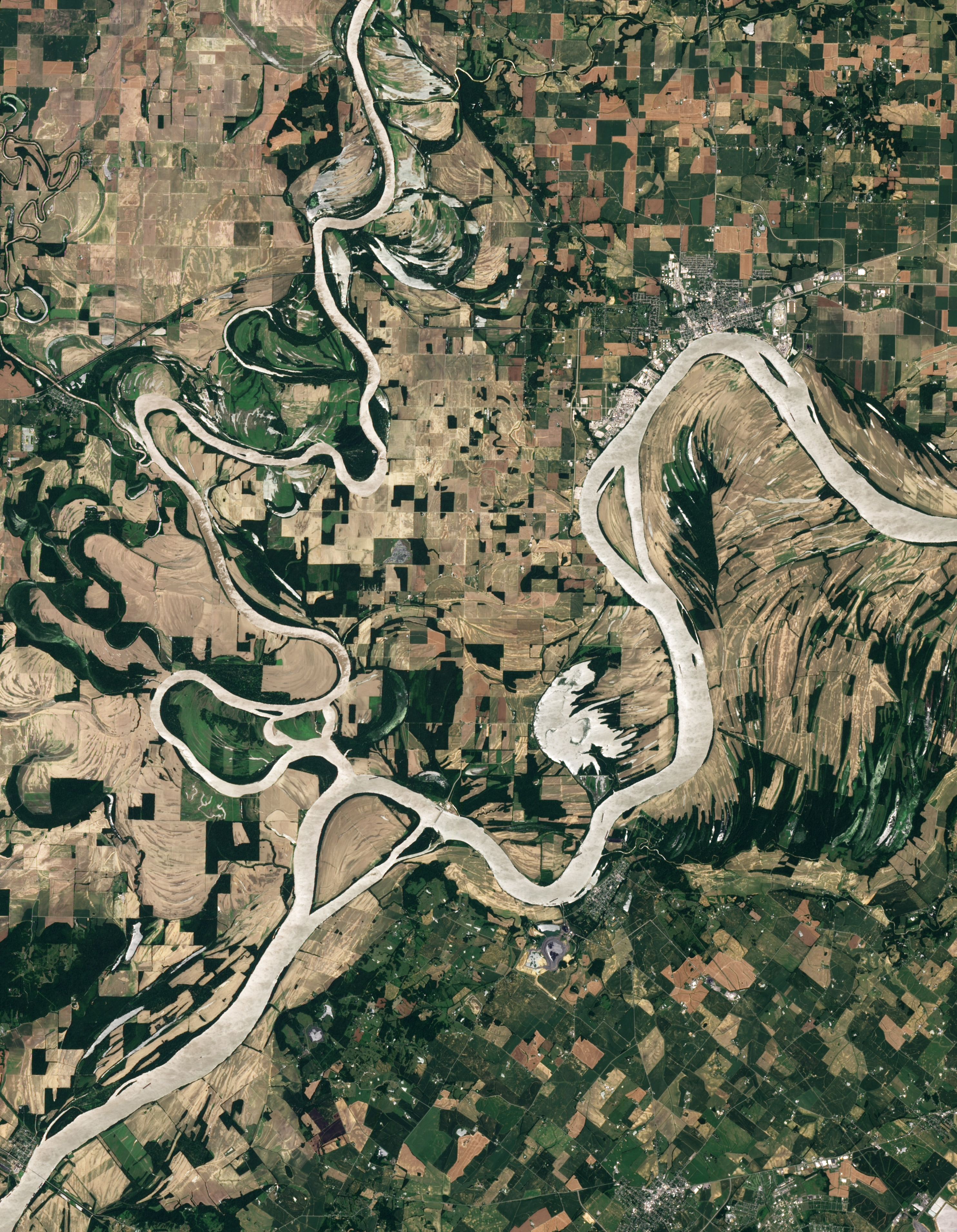
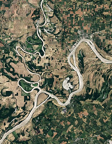
English:
Natural-colour image of the Wabash-Ohio confluence. Both rivers, as well as Hovey Lake, appear silver-
grey
in this image, probably due to the reflection of
sunlight
off the
water
surface (
sunglint
). Away from the water, the land is a patchwork of croplands shaped by
human
design
, and floodplains shaped by overflowing rivers.
|
| Date | |
| Source | NASA Earth Observatory |
| Author | Robert Simmon |
Image captured by the Advanced Land Imager (ALI) on NASA’s Earth Observing-1 (EO-1) satellite. EO-1 ALI data provided courtesy of the NASA EO-1 team.
Licensing
|
|
This file is in the public domain in the United States because it was solely created by NASA . NASA copyright policy states that "NASA material is not protected by copyright unless noted ". (See Template:PD-USGov , NASA copyright policy page or JPL Image Use Policy .) |
|

|
Warnings:
|
| Annotations | This image is annotated: View the annotations at Commons |