Flood_Cottages,_Orcheston_-_geograph.org.uk_-_373142.jpg
No higher resolution available.
Summary
| Description |
English:
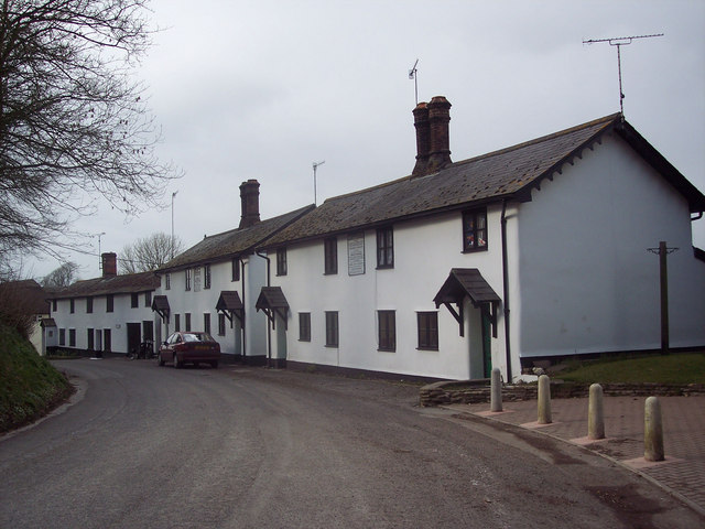
Flood Cottages, Orcheston A particularly devastating flood, created by a rapid thaw of snow, swept off the Plain into the Till Valley in January 1841 and wrought havoc through the villages of Tilshead, Orcheston, Shrewton and Winterbourne Stoke, destroying 47 houses and numerous farms. A number of cottages were built to house those who lost their homes.
|
| Date | |
| Source | From geograph.org.uk |
| Author | Trish Steel |
| Camera location |
|
View this and other nearby images on: OpenStreetMap |
|
|---|
_heading:337.00&language=en)
| Object location |
|
View this and other nearby images on: OpenStreetMap |
|
|---|
_heading:337.00&language=en)
Licensing

|
This image was taken from the
Geograph project
collection. See
this photograph's page
on the Geograph website for the photographer's contact details. The copyright on this image is owned by
Trish Steel
and is licensed for reuse under the
Creative Commons
Attribution-ShareAlike 2.0 license.
|
This file is licensed under the
Creative Commons
Attribution-Share Alike 2.0 Generic
license.
Attribution:
Trish Steel
-
You are free:
- to share – to copy, distribute and transmit the work
- to remix – to adapt the work
-
Under the following conditions:
- attribution – You must give appropriate credit, provide a link to the license, and indicate if changes were made. You may do so in any reasonable manner, but not in any way that suggests the licensor endorses you or your use.
- share alike – If you remix, transform, or build upon the material, you must distribute your contributions under the same or compatible license as the original.
- Remove redundant categories and try to put this image in the most specific category/categories
- Remove this template
- The location categories are based on information from this geonames tool and this OpenStreetMap tool combined with a database. You can also have a look at this tool from mysociety .
- The topic category from Geograph was Cottages (find similar images at Geograph )