Finland_1996_CIA_map.jpg
Size of this preview:
498 × 599 pixels
.
Other resolutions:
199 × 240 pixels
|
399 × 480 pixels
|
638 × 768 pixels
|
851 × 1,024 pixels
|
1,662 × 2,000 pixels
.
| Description |
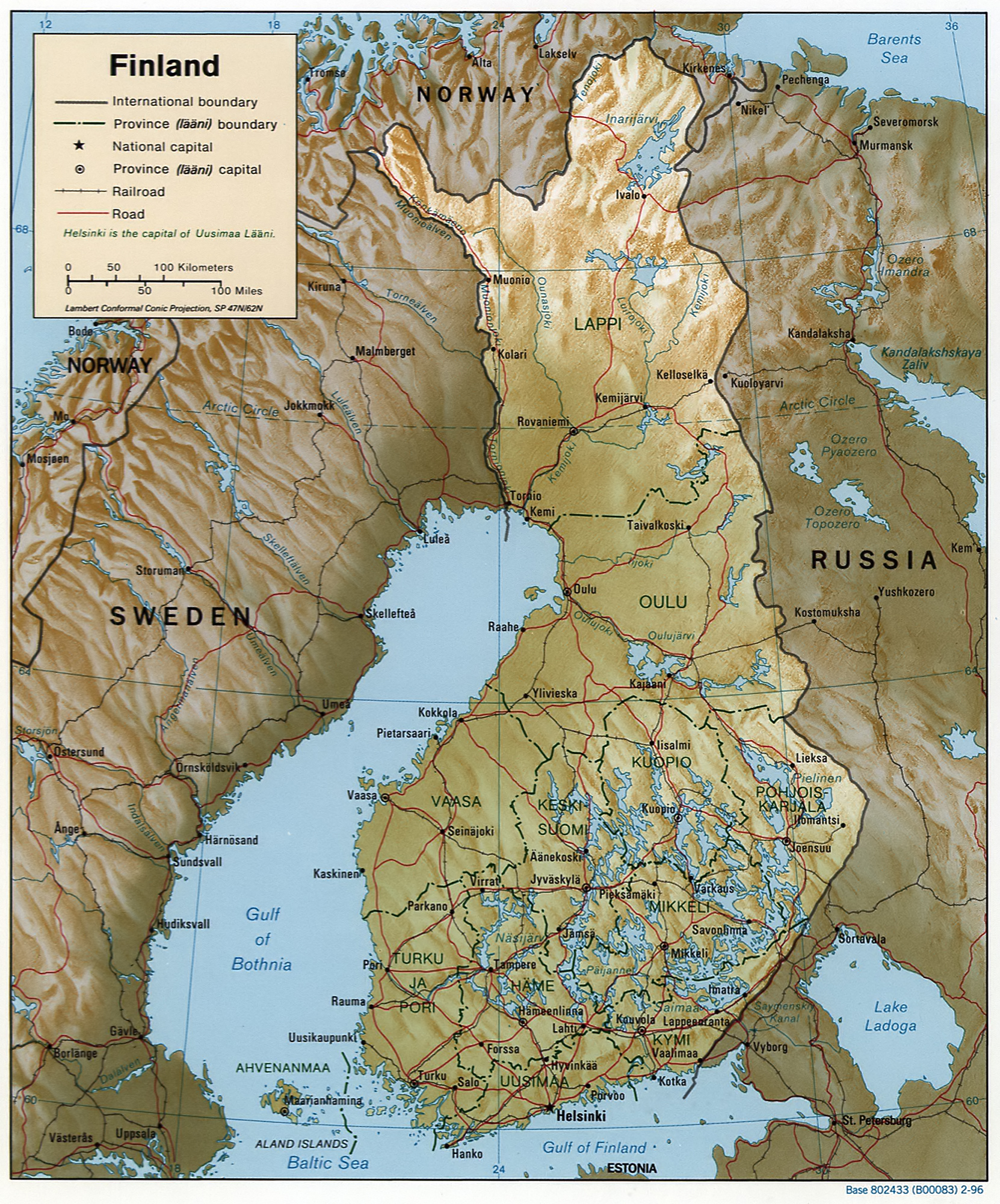
English:
Map of Finland, relief shown by shading.
Scale [ca. 1:6,250,000]; Lambert conformal conic proj. (E 180--E 340/N 720--N 590); map 20 x 17 cm; "Base 802433 (B00083) 2-96." |
|||
| Date | ||||
| Source |
REPOSITORY Library of Congress Geography and Map Division Washington, D.C. 20540-4650 USA
DIGITAL ID g6960 ct001018 http://hdl.loc.gov/loc.gmd/g6960.ct001018 CALL NUMBER G6960 1996 .U6 |
|||
| Author | Central Intelligence Agency, Washington, D.C., United States. | |||
|
Permission
( Reusing this file ) |
|
