FejérMegye.png

Size of this preview:
800 × 533 pixels
.
Other resolutions:
320 × 213 pixels
|
640 × 426 pixels
|
1,123 × 748 pixels
.
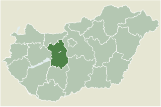
Location map for Fejér county, Hungary.
- From: http://hu.wikipedia.org
- Created by: hu:User:Juhasz peter , 2005. július 1.

|
File:HU county Fejer.svg
is a vector version of this file. It should be used in place of this PNG file when not inferior.
File:FejérMegye.png →
File:HU county Fejer.svg
For more information, see
Help:SVG
.
|

|

|
Permission is granted to copy, distribute and/or modify this document under the terms of the GNU Free Documentation License , Version 1.2 or any later version published by the Free Software Foundation ; with no Invariant Sections, no Front-Cover Texts, and no Back-Cover Texts. A copy of the license is included in the section entitled GNU Free Documentation License . |
|
|
This file is licensed under the Creative Commons Attribution-Share Alike 3.0 Unported license. | |
|
||
| This licensing tag was added to this file as part of the GFDL licensing update . |