This file was a
finalist
in
Picture of the Year 2021
.
This is a
featured picture
on Wikimedia Commons (
Featured pictures
) and is considered one of the finest images. See its nomination
here
.
This is a
featured picture
on the English language Wikipedia (
Featured pictures
) and is considered one of the finest images. See its nomination
here
.
The person who associated a work with this deed has dedicated the work to the
public domain
by waiving all of their rights to the work worldwide under copyright law, including all related and neighboring rights, to the extent allowed by law. You can copy, modify, distribute and perform the work, even for commercial purposes, all without asking permission.
http://creativecommons.org/publicdomain/zero/1.0/deed.en
CC0
Creative Commons Zero, Public Domain Dedication
false
false
License note:
Source page at
this link
archived
here
states: "Terms of Use - The maps on this page are in the public domain. You may use them any way you like, including modifying the content, digital and print reproduction, and selling them for profit. Consider these maps as yours."
Captions
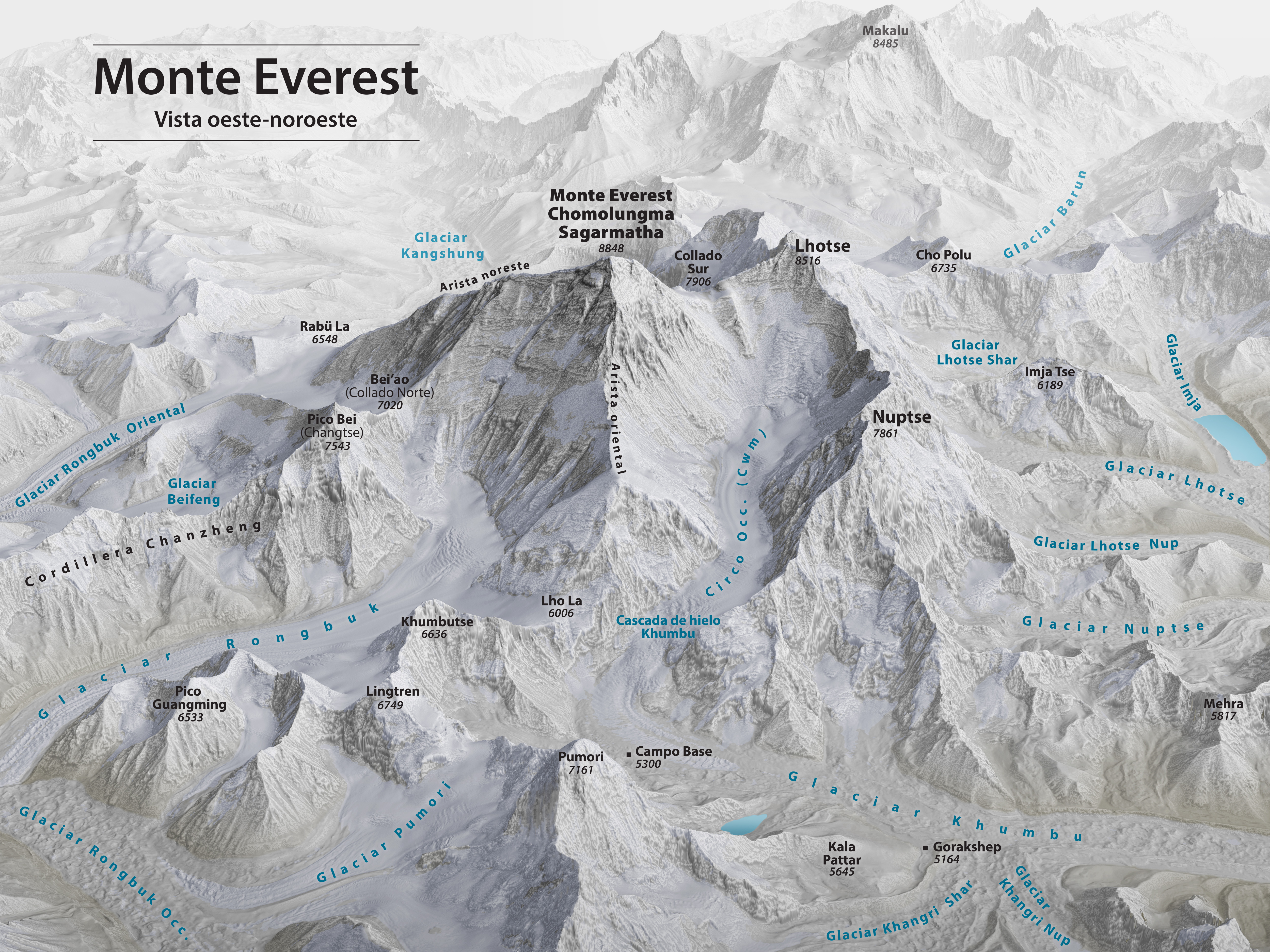
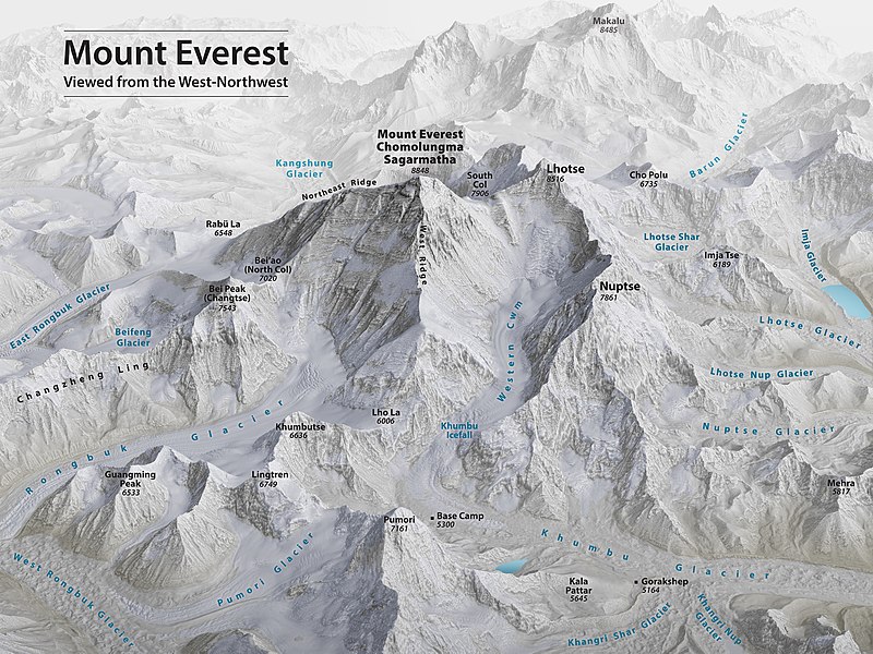
Mount Everest 3D Map by Tom Patterson with English annotation
3D mapa Mount Everestu od Toma Pattersona s anglickými poznámkami
3D kaart van de Mount Everest gemaakt door Tom Patterson met Engelse bijschriften


