Eruptions_in_the_Lassen_area_in_the_last_50,000_years-map.jpg


Summary

Description
English: 
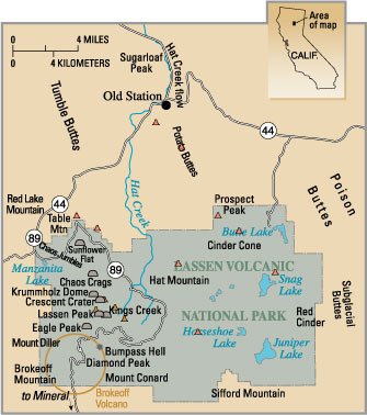
Map — Eruptions in the Lassen area in the last 50,000 years.
Source PD USGS image from http://pubs.usgs.gov/fs/2000/fs022-00/
Author
Public domain
This image is in the public domain in the United States because it only contains materials that originally came from the United States Geological Survey , an agency of the United States Department of the Interior . For more information, see the official USGS copyright policy .

Bahasa Indonesia català čeština Deutsch eesti English español français galego italiano Nederlands português polski sicilianu suomi Tiếng Việt Türkçe български македонски русский മലയാളം 한국어 日本語 中文 中文(简体) 中文(繁體) العربية فارسی +/−

Captions

The Map

Items portrayed in this file

depicts