Eocene_Europe_amber_map.jpg

Size of this preview:
742 × 600 pixels
.
Other resolutions:
297 × 240 pixels
|
594 × 480 pixels
|
950 × 768 pixels
|
1,267 × 1,024 pixels
|
1,492 × 1,206 pixels
.
Summary
| Description |
English:
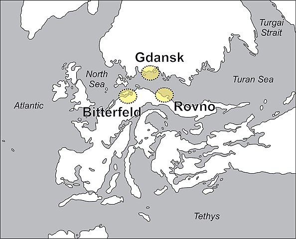
Paleogeographic map of Europe during the early to middle Eocene. Yellow areas indicate the position of the present-day amber Lagerstätten at Bitterfeld, Gdansk and Rovno. Modified after Popov et al. 2004, Denk and Grimm 2009, Blakey 2011, Szwedo and Sontag 2013, and Wolfe et al. 2016.
|
| Date | |
| Source | https://evolsyst.pensoft.net/article/22581/list/8/ |
| Author | Jason A. Dunlop, Ulrich Kotthoff, Jörg U. Hammel, Jennifer Ahrens, Danilo Harms |
|
Permission
( Reusing this file ) |
This file is licensed under the
Creative Commons
Attribution 4.0 International
license.
|