El_ruiz_volcano.jpg
Size of this preview:
800 × 599 pixels
.
Other resolutions:
320 × 239 pixels
|
640 × 479 pixels
|
1,024 × 766 pixels
|
1,280 × 958 pixels
|
2,288 × 1,712 pixels
.
Summary
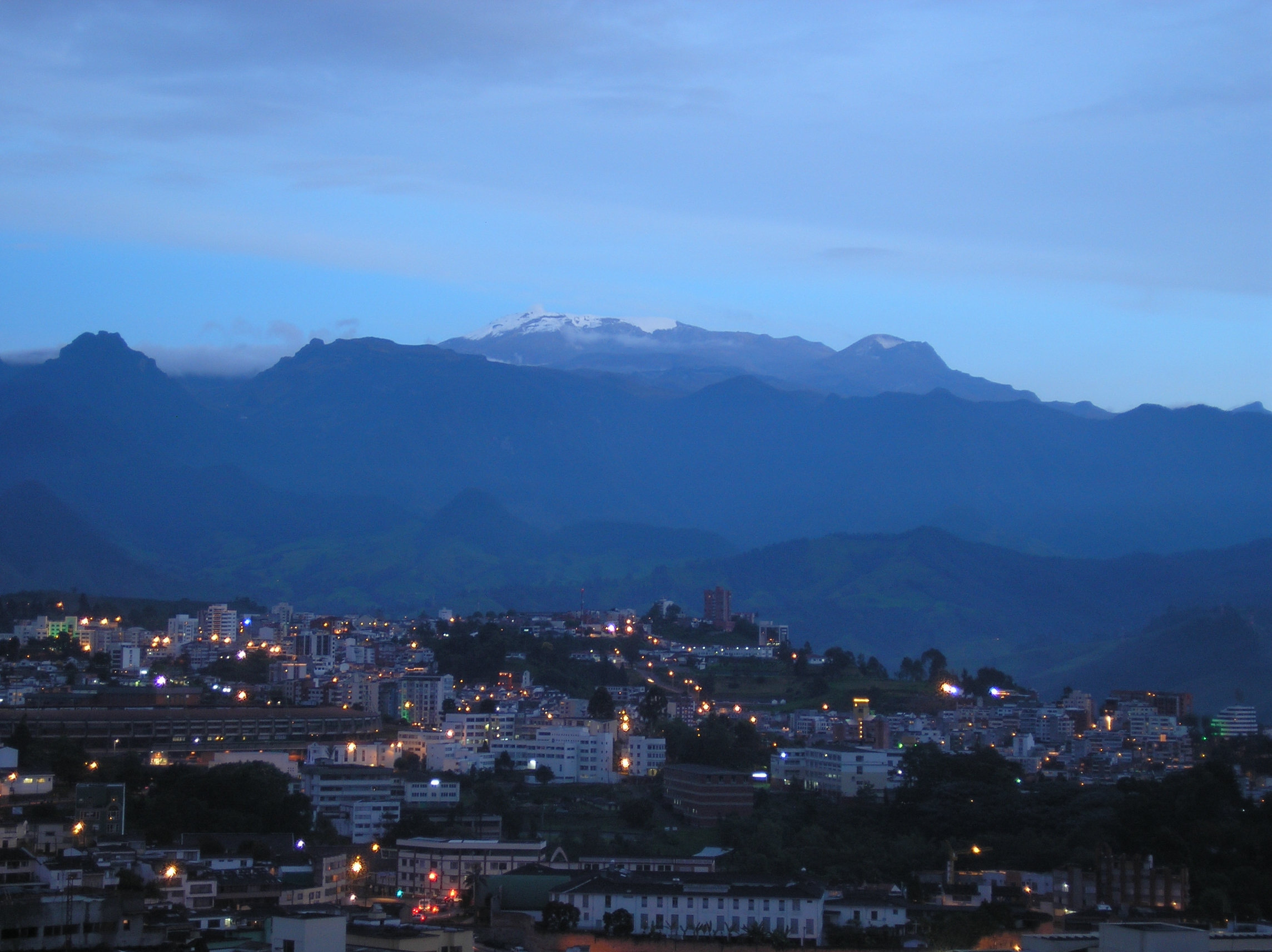
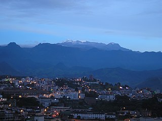
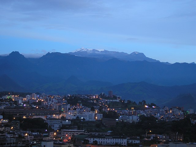
| Description | "Nevado del Ruiz" (El Ruiz snow peak). Part of Los Nevados National Park. I took this picture on December 27, 2006 at around 6:30 pm local time, from Manizales. 20 years ago, snow used to cover the mountain peak and the "La Olleta" volcano. The top left of the mountain is showing signs of activity coming from the Arenas crater, which points to the other side (eastward) of Los Andes mountain range. This crater exploded in 1985, causing a lahar that buried the 25.000-people city of Armero in the middle of the night. Still, the Nevado del Ruiz remains one of the most beautiful natural attractions, not only in Manizales, but Colombia. |
| Date | |
| Source | Own work |
| Author | Foj333 |
Licensing
|
|
I, the copyright holder of this work, release this work into the
public domain
. This applies worldwide.
In some countries this may not be legally possible; if so: I grant anyone the right to use this work for any purpose , without any conditions, unless such conditions are required by law. |
Original upload log
The original description page was
here
. All following user names refer to en.wikivoyage-old.
- 2007-01-21 00:59 (WT-en) Foj333 2288×1712 (1694505 bytes) "El Nevado del Ruiz" (El Ruiz snow peak). Part of the Los Nevados National Park. I took this picture on December 27, 2006 at around 6:30 pm loca (Import from wikitravel.org/en)