EIN_AFEQ_AERIAL_B.JPG

Size of this preview:
800 × 533 pixels
.
Other resolutions:
320 × 213 pixels
|
640 × 426 pixels
|
1,024 × 682 pixels
|
1,280 × 852 pixels
|
2,986 × 1,988 pixels
.
Summary
| Description |
עברית:
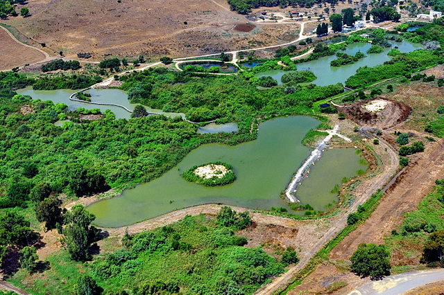
שמורת טבע בעמק זבולון, מזרחית לקריית ביאליק. השמורה כוללת הן את המעיינות והביצות המהווים את מקורו של נחל נעמן והן את האתר הארכאולוגי תל אפק. השמורה הוכרזה ב-1979 והיא משתרעת על פני 660 דונם. ב-1996 הוכרה השמורה כ"אתר רמסר" בהתאם לאמנת רמסר לשימור ולפיתוח בר-קיימא של בתי גידול לחים.
|
||
| Date | |||
| Source | Own work | ||
| Author | AVRAMGR |
| Camera location |
|
View this and other nearby images on: OpenStreetMap |
|
|---|
Licensing
I, the copyright holder of this work, hereby publish it under the following license:
This file is licensed under the
Creative Commons
Attribution-Share Alike 4.0 International
license.
-
You are free:
- to share – to copy, distribute and transmit the work
- to remix – to adapt the work
-
Under the following conditions:
- attribution – You must give appropriate credit, provide a link to the license, and indicate if changes were made. You may do so in any reasonable manner, but not in any way that suggests the licensor endorses you or your use.
- share alike – If you remix, transform, or build upon the material, you must distribute your contributions under the same or compatible license as the original.

|
This image was uploaded as part of
Wiki Loves Monuments 2015
.
|

|