EF1_damage_Richardson,_Texas.jpg

Size of this preview:
800 × 534 pixels
.
Other resolutions:
320 × 213 pixels
|
640 × 427 pixels
|
964 × 643 pixels
.
Summary
| Description |
English:
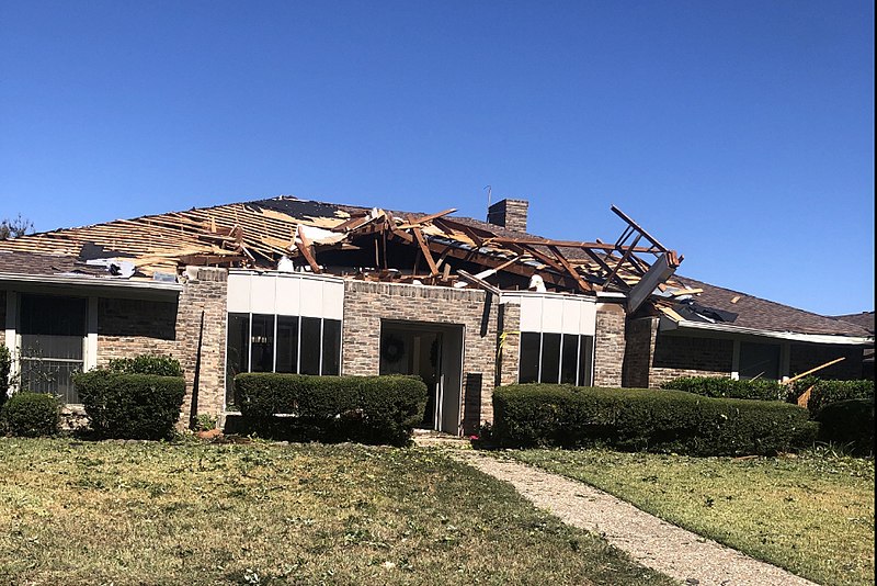
Example of EF1 tornado damage. This house in Richardson, Texas lost a large section of its roof surface to a tornado. The image has been cropped to focus on the damaged house.
|
| Date | |
| Source | https://services.dat.noaa.gov/arcgis/rest/services/nws_damageassessmenttoolkit/DamageViewer/MapServer/0/1987364/attachments/1238623 |
| Author | National Weather Service Forecast Office in Dallas/Fort Worth, Texas |
Licensing
|
|
This image is in the
public domain
because it was stored on the web servers of the U.S.
National Oceanic and Atmospheric Administration
, specifically on the
Damage Assessment Toolkit
(DAT), an interactive
map
and
database
. Images on the Damage Assessment Toolkit are taken by the
122 National Weather Service forecast offices
as well as the
National Severe Storms Laboratory
.
Thus, all images on the Damage Assessment Toolkit are public domain.
|
|