Duchy_of_Nassau.png
Size of this preview:
457 × 600 pixels
.
Other resolutions:
183 × 240 pixels
|
366 × 480 pixels
|
1,004 × 1,318 pixels
.
Summary
| Description |
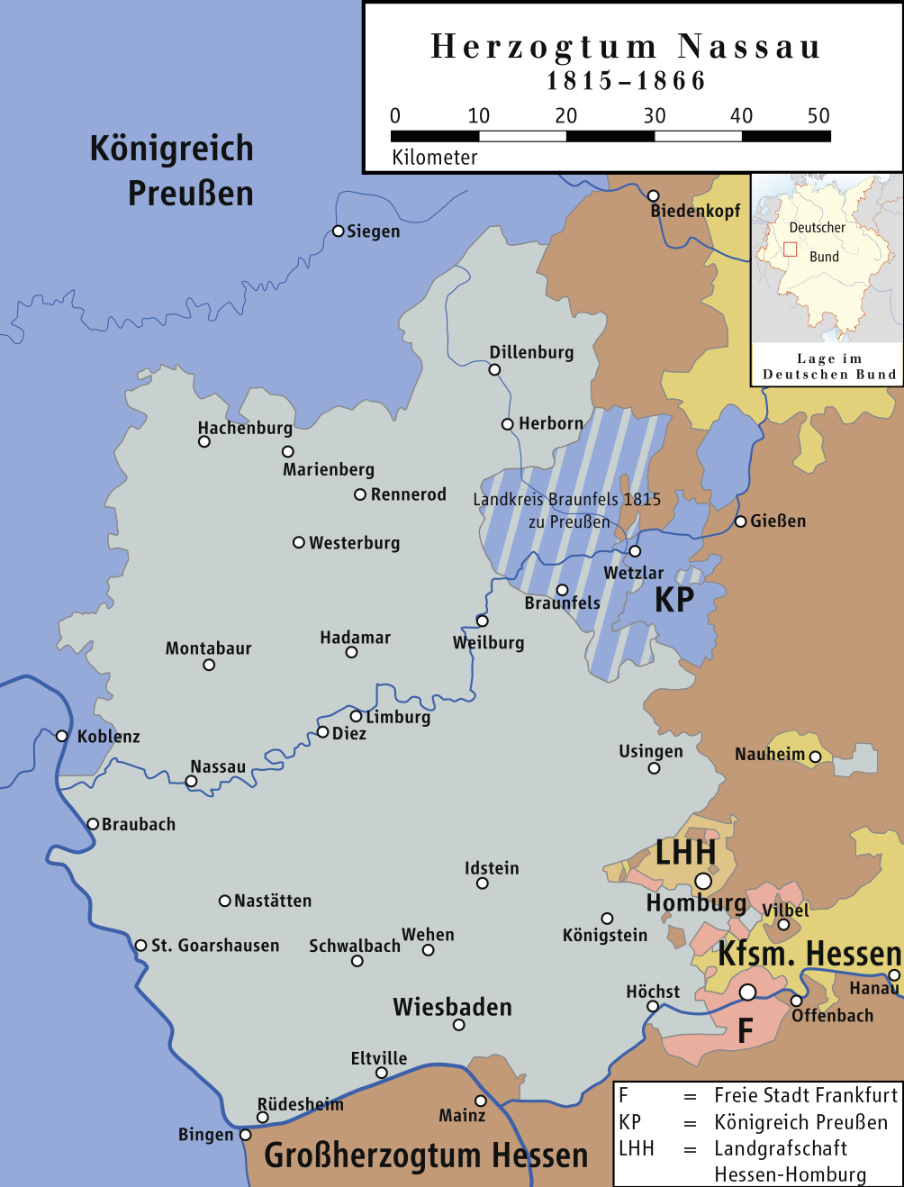
Deutsch:
Karte des Herzogtums Nassau 1815–1866, die Ämter Braunfels, Greifenstein und Hohensolms sind schraffiert. Diese kamen nach dem Wiener Kongress zu Preußen (Landkreis Braunfels) und blieben Teil der
Rheinprovinz
, auch als das restliche Herzogtum Nassau 1866 Teil der preußischen Provinz
Hessen-Nassau
wurde.
|
||||||||
| Date | |||||||||
| Source | own drawing/Source of Information: Putzger – Historischer Weltatlas, 89. Auflage, 1965; Westermanns Großer Atlas zuur Weltgeschichte, 1969; Haacks geographischer Atlas. VEB Hermann Haack Geographisch-Kartographische Anstalt, Gotha/Leipzig, 1. Auflage, 1979; dtv-Atlas zur Weltgeschichte Band 1: Von den Anfängen bis zur Französischen Revolution; 23. Aufl. 1989, ISBN 3-423-03002-X | ||||||||
| Author | ziegelbrenner | ||||||||
|
Permission
( Reusing this file ) |
I, the copyright holder of this work, hereby publish it under the following licenses:
This file is licensed under the
Creative Commons
Attribution 2.5 Generic
license.
You may select the license of your choice.
|


|
This map has been made or improved in the German
Kartenwerkstatt
(Map Lab)
. You can
propose maps
to improve as well.
|