Donegal_Carrickfin_Airport_-_View_to_the_east_-_geograph.org.uk_-_1174831.jpg
No higher resolution available.
Summary
| Description |
English:
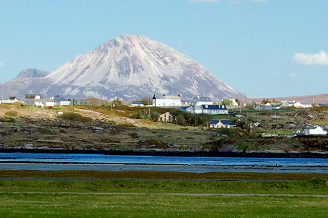
Donegal Carrickfin Airport - View to the east Shown in the foreground is the peninsula that the airport is located on and a small bay east of that peninsula. Shown in the near background is part of a residential area near Rinnafarset. Beyond that is the awesome sight of Mount Errigal.
|
||
| Date | |||
| Source | From geograph.org.uk | ||
| Author | Joseph Mischyshyn | ||
|
Permission
( Reusing this file ) |
This file is licensed under the
Creative Commons
Attribution-Share Alike 2.0 Generic
license.
Attribution:
Joseph Mischyshyn
|
||
|
Attribution
( required by the license ) |
Joseph Mischyshyn / Donegal Carrickfin Airport - View to the east / | ||

| Camera location |
|
View this and other nearby images on: OpenStreetMap |
|
|---|
_heading:90.00&language=en)
| Object location |
|
View this and other nearby images on: OpenStreetMap |
|
|---|
_heading:90.00&language=en)