Dialetti_Italia_1939.png
No higher resolution available.
Summary
| Description |
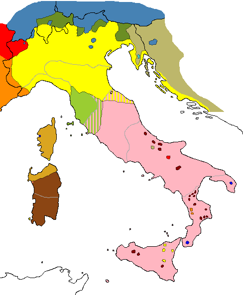
English:
Italian dialects before 1939
Italiano:
Dialetti italiani prima del 1939
|
||
| Date | (UTC) | ||
| Source |
Carlo Tagliavini
Le origini delle lingue neolatine
, Bologna, 1982, p. 397; Clemente Merlo,
Lingue e dialetti d'Italia
, Milano, 1937, p. 4.
|
||
| Author |

| Annotations | This image is annotated: View the annotations at Commons |
Licensing
I, the copyright holder of this work, hereby publish it under the following license:
|
|
I, the copyright holder of this work, release this work into the
public domain
. This applies worldwide.
In some countries this may not be legally possible; if so: I grant anyone the right to use this work for any purpose , without any conditions, unless such conditions are required by law. |
Original upload log
Uploaded with
derivativeFX
This image is a derivative work of the following images:
-
File:Europe-nofill-hires.png
licensed with PD-self
- 2007-07-12T19:34:36Z KoenB 1897x2048 (417092 Bytes) {{Information |Description=A map of Europe using Lambert's Conformal Conical Projection; standard parallels: 40 deg & 56 deg; central meridian: 10 deg |Source=world_borders.shp; "The world_borders.zip dataset is Shapefile of