Deutschland_Bundeslaender_1957.svg

Size of this PNG preview of this SVG file:
443 × 599 pixels
.
Other resolutions:
177 × 240 pixels
|
355 × 480 pixels
|
567 × 768 pixels
|
757 × 1,024 pixels
|
1,513 × 2,048 pixels
|
592 × 801 pixels
.
Summary
| Description |
Deutsch:
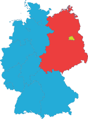
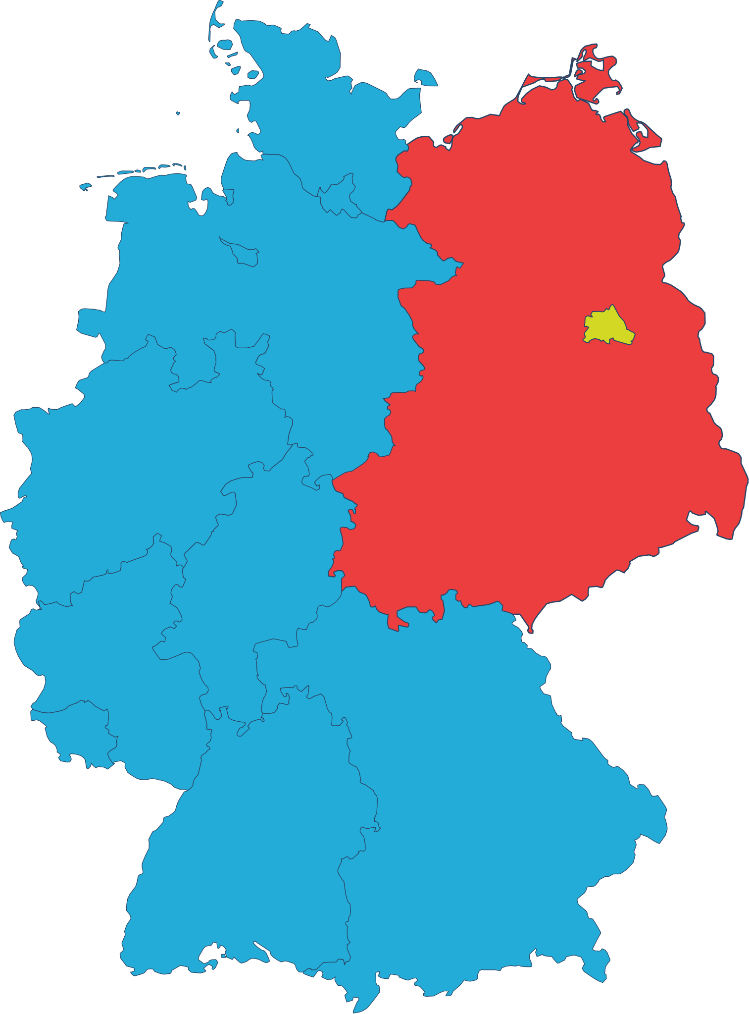
Bundesrepublik (blau), Berlin (gelb) und DDR ohne Ost-Berlin (rot). Stand von 1963 (d.h. mit Saarland und dem Selfkant) bis 1990
Diese Datei enthält einen Fehler! Das Amt Neuhaus (heute Niedersachsen, damals DDR-Bezirk Schwerin) gehörte bis 1990 zur DDR, ist hier aber als Teil von Niedersachsen in blau (Bundesrepublik) dargestellt. Die PNG-Version Deutschland_Bundeslaender_1957.png stellt den damaligen Grenzverlauf korrekt dar.
|
| Date | |
| Source |
{Derived from}
|
| Author | Lang Constantin |
| SVG development |


Licensing
I, the copyright holder of this work, hereby publish it under the following license:
This file is licensed under the
Creative Commons
Attribution-Share Alike 4.0 International
license.
-
You are free:
- to share – to copy, distribute and transmit the work
- to remix – to adapt the work
-
Under the following conditions:
- attribution – You must give appropriate credit, provide a link to the license, and indicate if changes were made. You may do so in any reasonable manner, but not in any way that suggests the licensor endorses you or your use.
- share alike – If you remix, transform, or build upon the material, you must distribute your contributions under the same or compatible license as the original.