Detailed_map_of_Benson,_Arizona.png
No higher resolution available.

|
This
city map
image could be re-created
using
vector graphics
as an
SVG
file
. This has several advantages; see
Commons:Media for cleanup
for more information. If an SVG form of this image is available, please upload it and afterwards replace this template with
{{

vector version available

|

new image name

}}
.
It is recommended to name the SVG file “Detailed map of Benson, Arizona.svg”—then the template Vector version available (or Vva ) does not need the new image name parameter. |
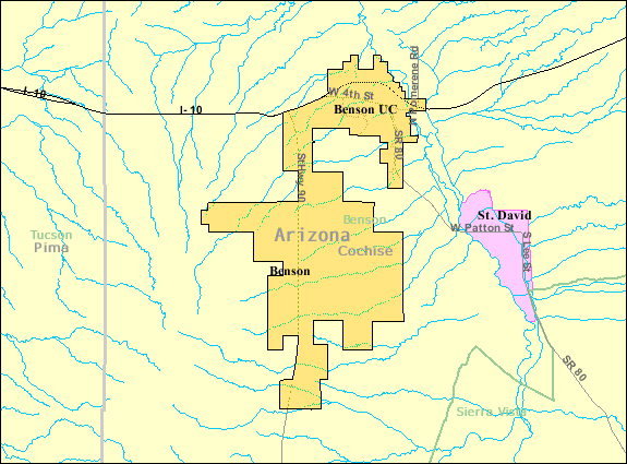
| Description | Map of Benson , a city in Cochise County , Arizona , United States , with its boundaries at the time of the 2000 census . | |||
| Date | Unknown date ; downloaded by me on 13 December 2008 | |||
| Source | http://factfinder.census.gov/leg2/46/120825446.gif , from http://factfinder.census.gov | |||
| Author | United States Census Bureau | |||
|
Permission
( Reusing this file ) |
|
