Denver_Basin_Location_Map.png
Size of this preview:
367 × 599 pixels
.
Other resolutions:
147 × 240 pixels
|
294 × 480 pixels
|
750 × 1,225 pixels
.
Summary
| Description |
English:
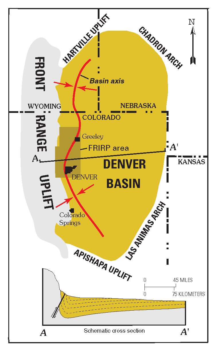
Location of the Denver Basin
|
| Date | |
| Source | http://pubs.usgs.gov/circ/c1219/ |
| Author | Daniel H. Knepper, Jr. (editor), US Geological Survey |
Licensing
|
|
This image is in the
public domain
in the United States because it only contains materials that originally came from the
United States Geological Survey
, an agency of the
United States Department of the Interior
. For more information, see
the official USGS copyright policy
.
|
|