Denver_Basin_Cross_Section.png
Size of this preview:
800 × 364 pixels
.
Other resolutions:
320 × 146 pixels
|
640 × 291 pixels
|
1,444 × 657 pixels
.
Summary
| Description |
English:
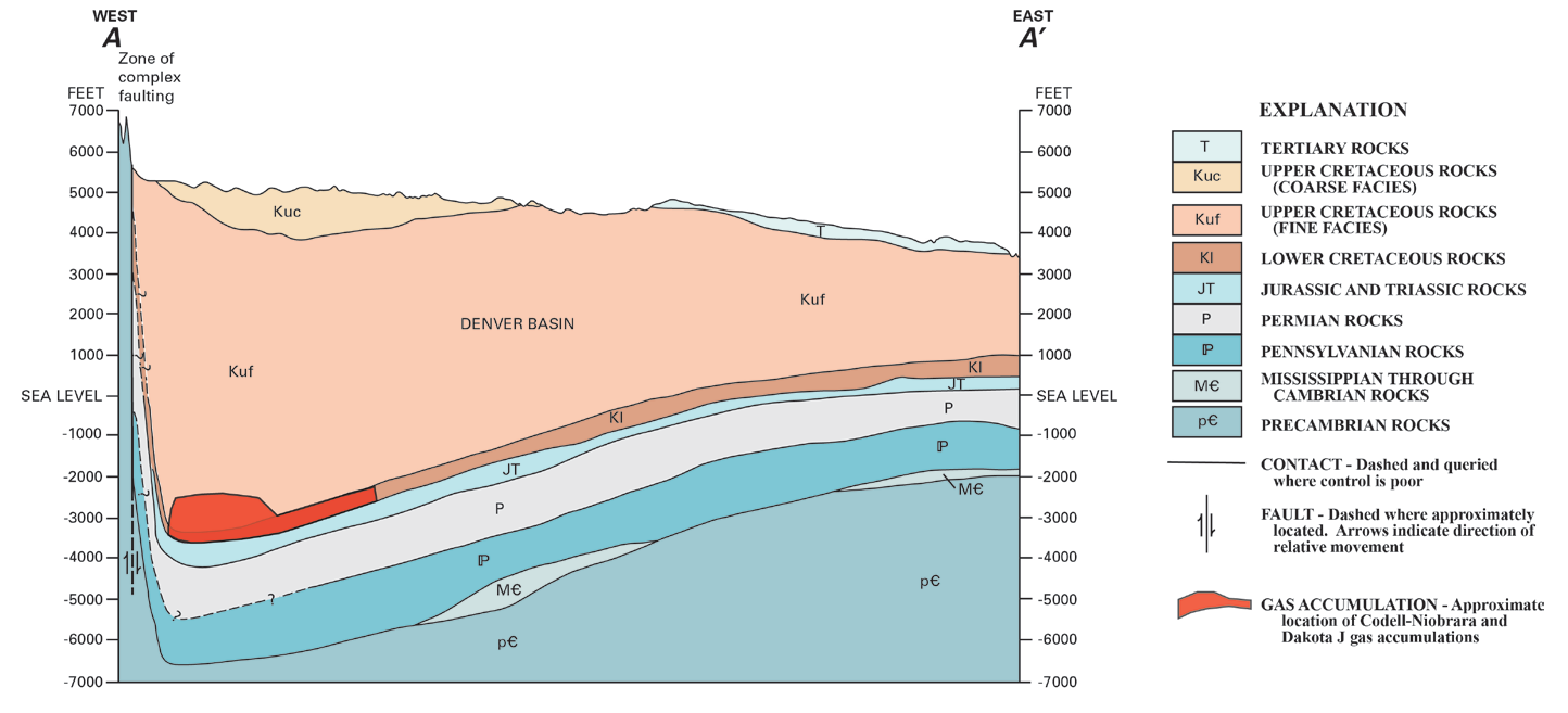
East-West cross-section through the Denver Basin
|
| Date | |
| Source | http://pubs.usgs.gov/of/2011/1175/pdf/OF11-1175.pdf |
| Author | Philip H. Nelson and Stephen L. Santus, US Geological Survey |
"Gas, Oil, and Water Production from Wattenberg Field in the Denver Basin, Colorado," USGS Open-File Report 2011-1175
Licensing
|
|
This image is in the
public domain
in the United States because it only contains materials that originally came from the
United States Geological Survey
, an agency of the
United States Department of the Interior
. For more information, see
the official USGS copyright policy
.
|
|

|
This
graph
image could be re-created
using
vector graphics
as an
SVG
file
. This has several advantages; see
Commons:Media for cleanup
for more information. If an SVG form of this image is available, please upload it and afterwards replace this template with
{{

vector version available

|

new image name

}}
.
It is recommended to name the SVG file “Denver Basin Cross Section.svg”—then the template Vector version available (or Vva ) does not need the new image name parameter. |