DC_satellite_image.jpg

Size of this preview:
512 × 599 pixels
.
Other resolutions:
205 × 240 pixels
|
410 × 480 pixels
|
656 × 768 pixels
|
1,230 × 1,440 pixels
.
Summary
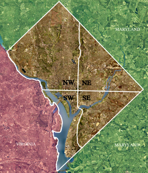
| Description | USGS satellite image of the District of Columbia , modified to show territorial boundary and quadrant divisions. |
| Date | Taken on 26 April 2002 |
| Source | USGS satellite image |
| Author | USGS, modified by User:Postdlf |
| Other versions |
|
.jpg)
.jpg)

Licensing
|
|
This image is in the
public domain
in the United States because it only contains materials that originally came from the
United States Geological Survey
, an agency of the
United States Department of the Interior
. For more information, see
the official USGS copyright policy
.
|
|