Cífer_church.JPG

Size of this preview:
401 × 599 pixels
.
Other resolutions:
160 × 240 pixels
|
321 × 480 pixels
|
514 × 768 pixels
|
685 × 1,024 pixels
|
1,371 × 2,048 pixels
|
2,592 × 3,872 pixels
.
Summary
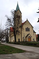
| Description |
Slovenčina:
Cífer (okr. Trnava), Kostol svätého Michala archanjela; celkový pohľad
English:
Cífer, Slovakia, Church
Čeština:
Cífer kostel
|
| Date | |
| Source | Own work |
| Author | feťour |
| Object location |
|
View this and other nearby images on: OpenStreetMap |
|
|---|
Licensing
|
|
I, the copyright holder of this work, release this work into the
public domain
. This applies worldwide.
In some countries this may not be legally possible; if so: I grant anyone the right to use this work for any purpose , without any conditions, unless such conditions are required by law. |