Cullingworth_Viaduct.jpg
No higher resolution available.
Summary
| Description |
English:
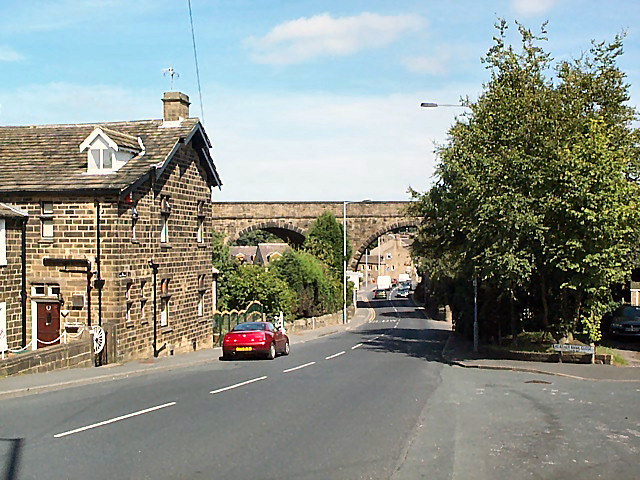
Cullingworth Viaduct At the southern end of the village, the long disused Great Northern viaduct crosses Haworth Road (the B6144 towards Bradford). The junction of the B6144 and the B6429 can be seen beyond. Cullingworth was on the Queensbury to Keighley line. The route has recently been opened to cyclists and pedestrians as part of the National Cycle Network.
|
| Date | |
| Source | From geograph.org.uk |
| Author | David Spencer |
|
Attribution
( required by the license ) |
David Spencer / Cullingworth Viaduct / |
| Camera location |
|
View this and other nearby images on: OpenStreetMap |
|
|---|
Licensing

|
This image was taken from the
Geograph project
collection. See
this photograph's page
on the Geograph website for the photographer's contact details. The copyright on this image is owned by
David Spencer
and is licensed for reuse under the
Creative Commons
Attribution-ShareAlike 2.0 license.
|
This file is licensed under the
Creative Commons
Attribution-Share Alike 2.0 Generic
license.
Attribution:
David Spencer
-
You are free:
- to share – to copy, distribute and transmit the work
- to remix – to adapt the work
-
Under the following conditions:
- attribution – You must give appropriate credit, provide a link to the license, and indicate if changes were made. You may do so in any reasonable manner, but not in any way that suggests the licensor endorses you or your use.
- share alike – If you remix, transform, or build upon the material, you must distribute your contributions under the same or compatible license as the original.