Crewe_railway_works_geograph-2150701.jpg
Size of this preview:
741 × 600 pixels
.
Other resolutions:
297 × 240 pixels
|
593 × 480 pixels
|
949 × 768 pixels
|
1,024 × 829 pixels
.
Summary
| Description |
English:
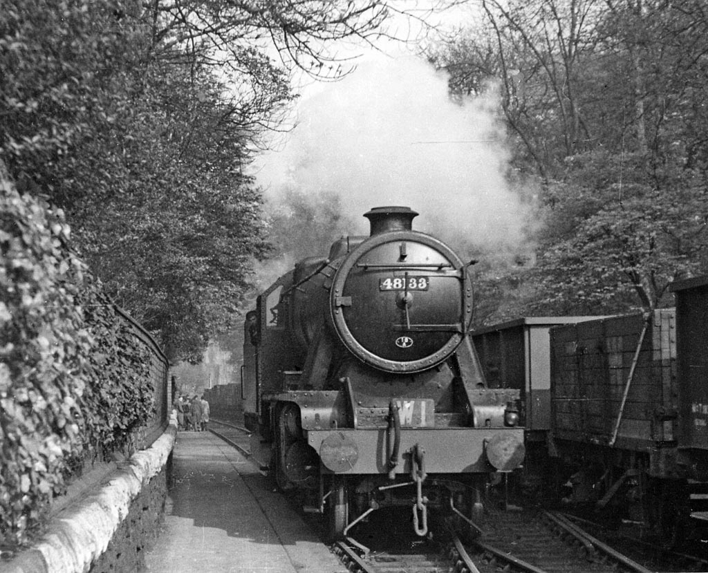
Stanier 8F 2-8-0 on the Crewe Works internal railway.
The 2-8-0, No 48133 (built 1941, withdrawn 11/66) is on Works Pilot job W1, running on what was originally (before the great expansion of the Works in July 1878) the main Crewe - Chester line but by the time of this photo formed part of the internal railway lines of the works. The view is eastward, between Flag Lane and Chester bridges. The occasion was a visit by the Railway Correspondence & Travel Society; some of whom can be glimpsed ahead, outside the entrance to the General Offices. |
| Date | |
| Source | From geograph.org.uk |
| Author | Ben Brooksbank |
|
Permission
( Reusing this file ) |
Creative Commons Attribution Share-alike license 2.0 |
| Camera location |
|
View this and other nearby images on: OpenStreetMap |
|
|---|
Licensing

|
This image was taken from the
Geograph project
collection. See
this photograph's page
on the Geograph website for the photographer's contact details. The copyright on this image is owned by
Ben Brooksbank
and is licensed for reuse under the
Creative Commons
Attribution-ShareAlike 2.0 license.
|
This file is licensed under the
Creative Commons
Attribution-Share Alike 2.0 Generic
license.
Attribution:
Ben Brooksbank
-
You are free:
- to share – to copy, distribute and transmit the work
- to remix – to adapt the work
-
Under the following conditions:
- attribution – You must give appropriate credit, provide a link to the license, and indicate if changes were made. You may do so in any reasonable manner, but not in any way that suggests the licensor endorses you or your use.
- share alike – If you remix, transform, or build upon the material, you must distribute your contributions under the same or compatible license as the original.