Cows_on_Selsley_Common_-_geograph.org.uk_-_192472.jpg
No higher resolution available.
Summary
| Description |
English:
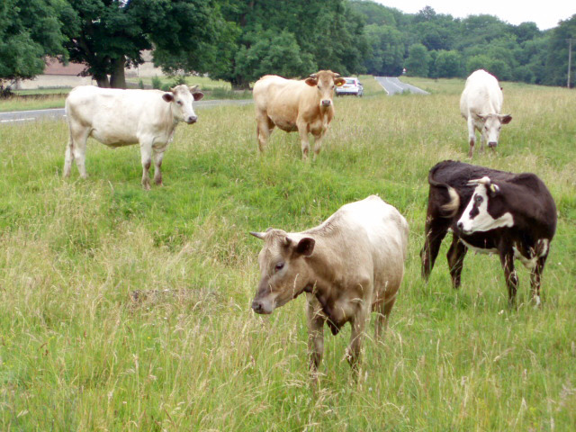
Cows on Selsley Common. With so much land to roam on, these cows have chosen to find pasture perilously close to the B4066. Cattle grids placed a strategic locations prevent the cattle from straying from the commonland.
Français :
Vaches sur les prés communaux de Selsley. Bien que disposant d'un vaste espace à brouter, ces vaches ont choisir de pâturer à une dangereusement proximité de la B4066 (risque de
roadkill
). Des grillages à Bovins placés à des endroits stratégiques peuvent empêcher la divagation du bétail des "commons"
|
| Date | |
| Source | From geograph.org.uk |
| Author | Sharon Loxton |
|
Attribution
( required by the license ) |
Sharon Loxton / Cows on Selsley Common / |
| Camera location |
|
View this and other nearby images on: OpenStreetMap |
|
|---|
_heading:202.00&language=en)
| Object location |
|
View this and other nearby images on: OpenStreetMap |
|
|---|
_heading:202.00&language=en)
Licensing

|
This image was taken from the
Geograph project
collection. See
this photograph's page
on the Geograph website for the photographer's contact details. The copyright on this image is owned by
Sharon Loxton
and is licensed for reuse under the
Creative Commons
Attribution-ShareAlike 2.0 license.
|
This file is licensed under the
Creative Commons
Attribution-Share Alike 2.0 Generic
license.
Attribution:
Sharon Loxton
-
You are free:
- to share – to copy, distribute and transmit the work
- to remix – to adapt the work
-
Under the following conditions:
- attribution – You must give appropriate credit, provide a link to the license, and indicate if changes were made. You may do so in any reasonable manner, but not in any way that suggests the licensor endorses you or your use.
- share alike – If you remix, transform, or build upon the material, you must distribute your contributions under the same or compatible license as the original.
- Remove redundant categories and try to put this image in the most specific category/categories
- Remove this template
- The location categories are based on information from this geonames tool and this OpenStreetMap tool combined with a database. You can also have a look at this tool from mysociety .
- The topic category from Geograph was Common (find similar images at Geograph )