Confluenceoftameandgoyt.JPG

Size of this preview:
450 × 600 pixels
.
Other resolutions:
180 × 240 pixels
|
360 × 480 pixels
|
768 × 1,024 pixels
.
Summary
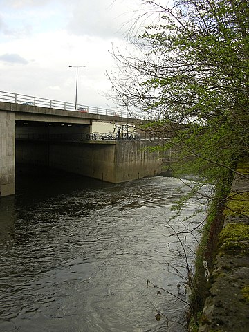
| Description | Photograph of the confluence of the en:River Tame and the en:River Goyt to form the en:River Mersey in en:Stockport . |
| Date | |
| Source | Own work |
| Author | Polishname |
|
Permission
( Reusing this file ) |
Released into the public domain (by author) |
| Camera location |
|
View this and other nearby images on: OpenStreetMap |
|
|---|
Licensing
|
|
I, the copyright holder of this work, release this work into the
public domain
. This applies worldwide.
In some countries this may not be legally possible; if so: I grant anyone the right to use this work for any purpose , without any conditions, unless such conditions are required by law. |