Colnbrook_station_site_geograph-3113303-by-Ben-Brooksbank.jpg
Size of this preview:
800 × 532 pixels
.
Other resolutions:
320 × 213 pixels
|
640 × 425 pixels
|
1,024 × 681 pixels
|
1,280 × 851 pixels
|
2,177 × 1,447 pixels
.
Summary
| Description |
English:
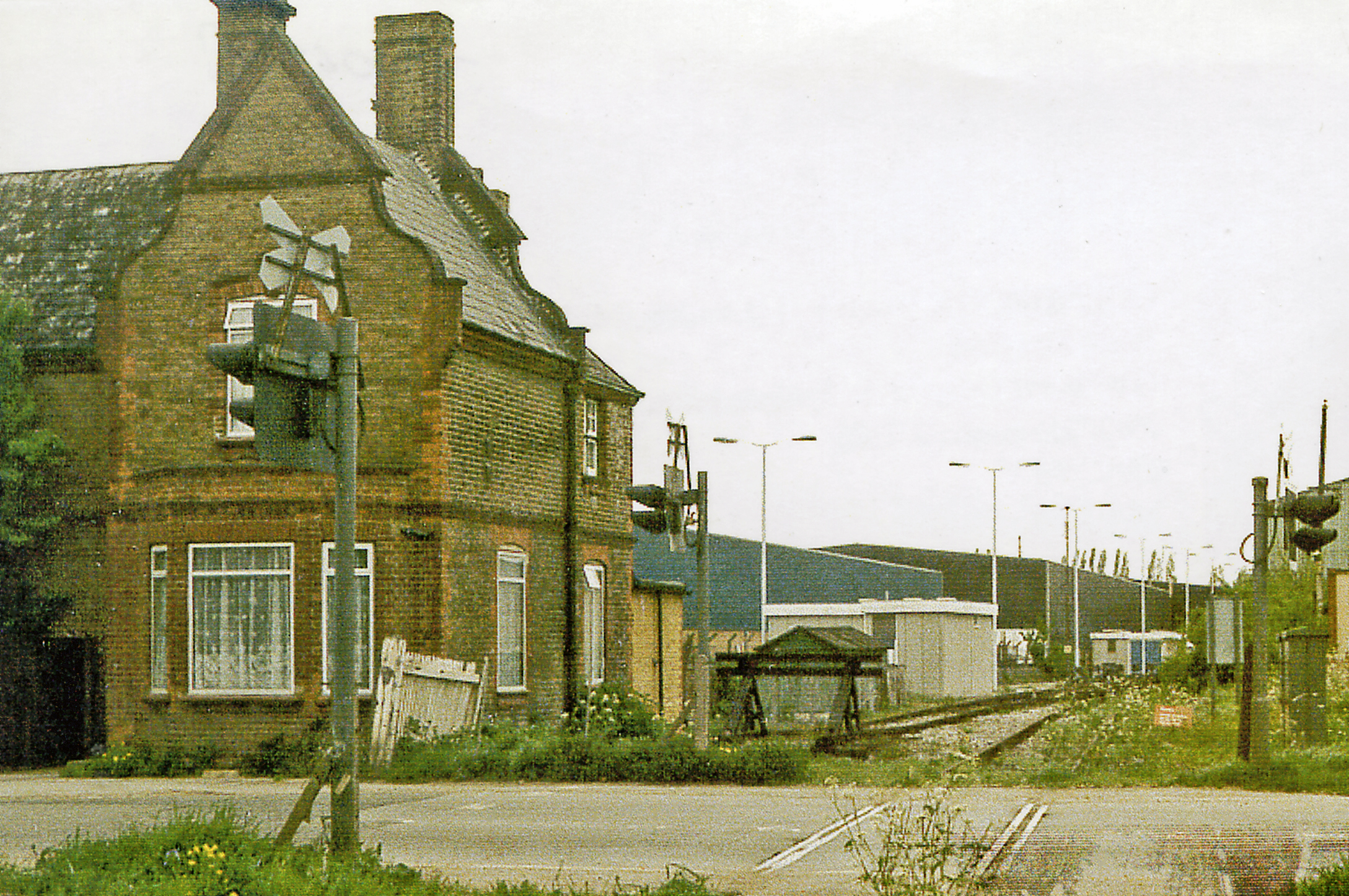
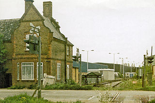
Site of Colnbrook station, 1986,
View northward across the B3378 (original Bath Road), towards West Drayton: ex-GWR West Drayton - Staines branch. The station was closed when the passenger service on the branch ceased from 29/3/65. Goods traffic ceased from 3/1/66, but as the photograph shows the line remains open to this point from West Drayton, for traffic to a fuel depot for Heathrow Airport and to an aggregates depot. |
| Date | |
| Source | From geograph.org.uk |
| Author | Ben Brooksbank |
|
Permission
( Reusing this file ) |
Creative Commons Attribution Share-alike license 2.0 |
|
Attribution
( required by the license ) |
Ben Brooksbank / Site of Colnbrook station, 1986 / |
| Camera location |
|
View this and other nearby images on: OpenStreetMap |
|
|---|
Licensing

|
This image was taken from the
Geograph project
collection. See
this photograph's page
on the Geograph website for the photographer's contact details. The copyright on this image is owned by
Ben Brooksbank
and is licensed for reuse under the
Creative Commons
Attribution-ShareAlike 2.0 license.
|
This file is licensed under the
Creative Commons
Attribution-Share Alike 2.0 Generic
license.
Attribution:
Ben Brooksbank
-
You are free:
- to share – to copy, distribute and transmit the work
- to remix – to adapt the work
-
Under the following conditions:
- attribution – You must give appropriate credit, provide a link to the license, and indicate if changes were made. You may do so in any reasonable manner, but not in any way that suggests the licensor endorses you or your use.
- share alike – If you remix, transform, or build upon the material, you must distribute your contributions under the same or compatible license as the original.