Christ_Church,_Solway_-_geograph.org.uk_-_87858.jpg
Size of this preview:
450 × 600 pixels
.
Other resolutions:
180 × 240 pixels
|
480 × 640 pixels
.
Summary
| Description |
English:
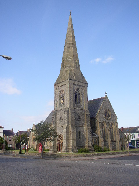
Christ Church, Solway. Christ Church was built of sandstone and Irish granite in 1870-1. Quite a large church, with nave and aisles, an apse, and a NW porch steeple with broach-spire. Inside all is brick-faced, yellow bricks with red-brick trim and also bands of brick projecting and recessed.
|
| Date | |
| Source | From geograph.org.uk |
| Author | Humphrey Bolton |
|
Attribution
( required by the license ) |
Humphrey Bolton / Christ Church, Solway / |
| Camera location |
|
View this and other nearby images on: OpenStreetMap |
|
|---|
_heading:337.00&language=en)
| Object location |
|
View this and other nearby images on: OpenStreetMap |
|
|---|
_heading:337.00&language=en)
Licensing

|
This image was taken from the
Geograph project
collection. See
this photograph's page
on the Geograph website for the photographer's contact details. The copyright on this image is owned by
Humphrey Bolton
and is licensed for reuse under the
Creative Commons
Attribution-ShareAlike 2.0 license.
|
This file is licensed under the
Creative Commons
Attribution-Share Alike 2.0 Generic
license.
Attribution:
Humphrey Bolton
-
You are free:
- to share – to copy, distribute and transmit the work
- to remix – to adapt the work
-
Under the following conditions:
- attribution – You must give appropriate credit, provide a link to the license, and indicate if changes were made. You may do so in any reasonable manner, but not in any way that suggests the licensor endorses you or your use.
- share alike – If you remix, transform, or build upon the material, you must distribute your contributions under the same or compatible license as the original.