Choapam_District,_Oaxaca.svg

Size of this PNG preview of this SVG file:
735 × 536 pixels
.
Other resolutions:
320 × 233 pixels
|
640 × 467 pixels
|
1,024 × 747 pixels
|
1,280 × 933 pixels
|
2,560 × 1,867 pixels
.
| Description |
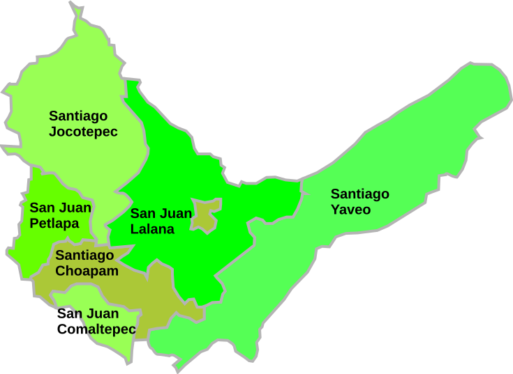
English:
Map of district of Choapam, Mexico.
|
| Date | (UTC) |
| Source | |
| Author |
|
|
|
This is a
retouched picture
, which means that it has been digitally altered from its original version. Modifications:
Adapted to show Choapam municipalitities
. The original can be viewed here:
Cosolapa en Oaxaca.svg
:
|
I, the copyright holder of this work, hereby publish it under the following license:
|
|
I, the copyright holder of this work, release this work into the
public domain
. This applies worldwide.
In some countries this may not be legally possible; if so: I grant anyone the right to use this work for any purpose , without any conditions, unless such conditions are required by law. |
Original upload log
This image is a derivative work of the following images:
-
File:Mapa_Acatlán_Pérez_Figueroa.svg
licensed with PD-self
- 2008-05-18T22:52:46Z El Ágora 925x660 (4084349 Bytes) {{Information |Description=={{en|Map of municipality of Acatlan de Perez Figueroa, Oaxaca, Mexico.}} {{es|Mapa del municipio de Acatlán de Pérez Figueroa, Oaxaca, México.}} |Source=self-made |Date=May 18, 2008 |Author= [[U
Uploaded with derivativeFX