Charing_Cross_Map_1901.png

Size of this preview:
778 × 600 pixels
.
Other resolutions:
312 × 240 pixels
|
623 × 480 pixels
|
997 × 768 pixels
|
1,280 × 987 pixels
|
2,560 × 1,973 pixels
|
3,616 × 2,787 pixels
.
Summary
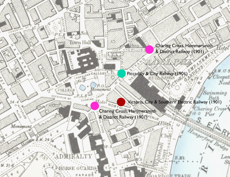
| Description | Map showing locations of stations proposed in 1901 in parliamentary bills for underground stations in the Charing Cross area. |
| Date | Revised 1893 to 1895. Edition Published 1894 to 1896 |
| Source | Base Map Ordnance Survey map: London VII.SW. Station locations: as described in London's Lost Tube Schemes by Antony Badsey-Ellis |
| Author | Unknown author |
|
This work is an
Ordnance Survey
map over 50 years old, which is covered by
Crown Copyright
which in this case expires 50 years after publication. Ordnance Survey does however ask that they be credited and that the date of publication be given.
Any ancillary rights gained through the creation of the electronic version are granted as freely usable under any circumstances.
|
|
|
This work
created by the United Kingdom Government
is in the
public domain
.
This is because it is one of the following :
HMSO has declared that the expiry of Crown Copyrights applies worldwide (ref:
HMSO Email Reply
)
|

|