ChannelCountryFloodingNASA.jpg

Size of this preview:
750 × 600 pixels
.
Other resolutions:
300 × 240 pixels
|
600 × 480 pixels
|
961 × 768 pixels
|
1,280 × 1,024 pixels
|
2,560 × 2,047 pixels
|
4,552 × 3,640 pixels
.
Summary
| Description |
English:
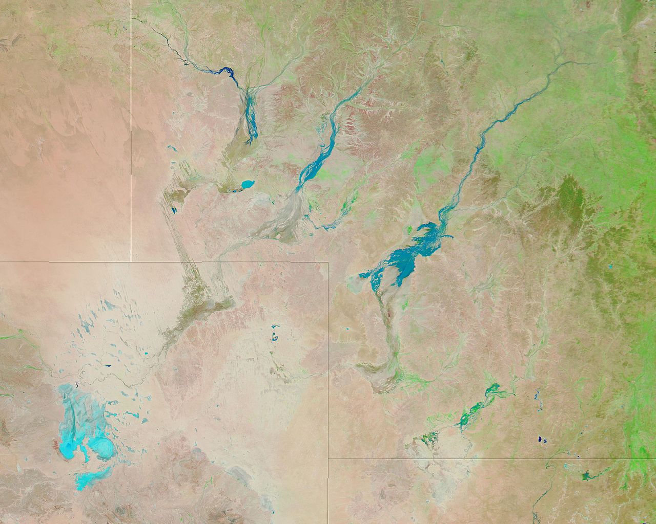
Image of southwestern Queensland (upper right), the southeastern Northern Territory (upper left), northeastern South Australia (lower left) and northwestern New South Wales (lower right), Australia, acquired on January 18, 2010. Lines superimposed on the image are boundaries between the said political entities. This image uses a combination of infrared and visible light to increase the contrast between water and land. Vegetation, even sparse vegetation, appears bright green. Clouds appear sky blue. Water varies in colour from electric blue to navy. Bare ground appears pink-brown. Davenport Downs, a cattle station, and Windorah, a little Outback town, are surrounded or soaked by floodwaters. This image covers roughly the area bounded by latitudes 22°S (top) and 30°S (bottom), and longitudes 136°E (left) and 147°E (right).
|
| Date | |
| Source | http://earthobservatory.nasa.gov/ |
| Author | NASA Earth Observatory |
| Other versions |


|
Licensing
|
|
This file is in the public domain in the United States because it was solely created by NASA . NASA copyright policy states that "NASA material is not protected by copyright unless noted ". (See Template:PD-USGov , NASA copyright policy page or JPL Image Use Policy .) |
|

|
Warnings:
|