Census2000_Percent_Black_Map.jpg
Size of this preview:
800 × 592 pixels
.
Other resolutions:
320 × 237 pixels
|
640 × 474 pixels
|
932 × 690 pixels
.

|
This
ethnographic map
image could be re-created
using
vector graphics
as an
SVG
file
. This has several advantages; see
Commons:Media for cleanup
for more information. If an SVG form of this image is available, please upload it and afterwards replace this template with
{{

vector version available

|

new image name

}}
.
It is recommended to name the SVG file “Census2000 Percent Black Map.svg”—then the template Vector version available (or Vva ) does not need the new image name parameter. |


Summary
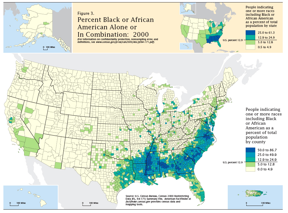
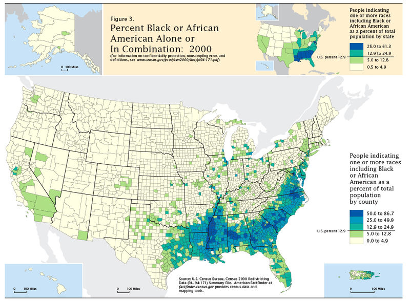
Map of population percentage reporting Black as race in the US Census 2000. Taken from https://www.census.gov/prod/2001pubs/c2kbr01-5.pdf and processed with Photoshop .
Licensing
|
|
This image or file is a work of a
United States Census Bureau
employee, taken or made as part of that person's official duties. As a
work
of the
U.S. federal government
, the image is in the
public domain
.
|

|