CarpOffshore.jpg
Size of this preview:
776 × 600 pixels
.
Other resolutions:
311 × 240 pixels
|
621 × 480 pixels
|
994 × 768 pixels
|
1,280 × 989 pixels
|
2,560 × 1,978 pixels
|
3,300 × 2,550 pixels
.
Summary
| Description |
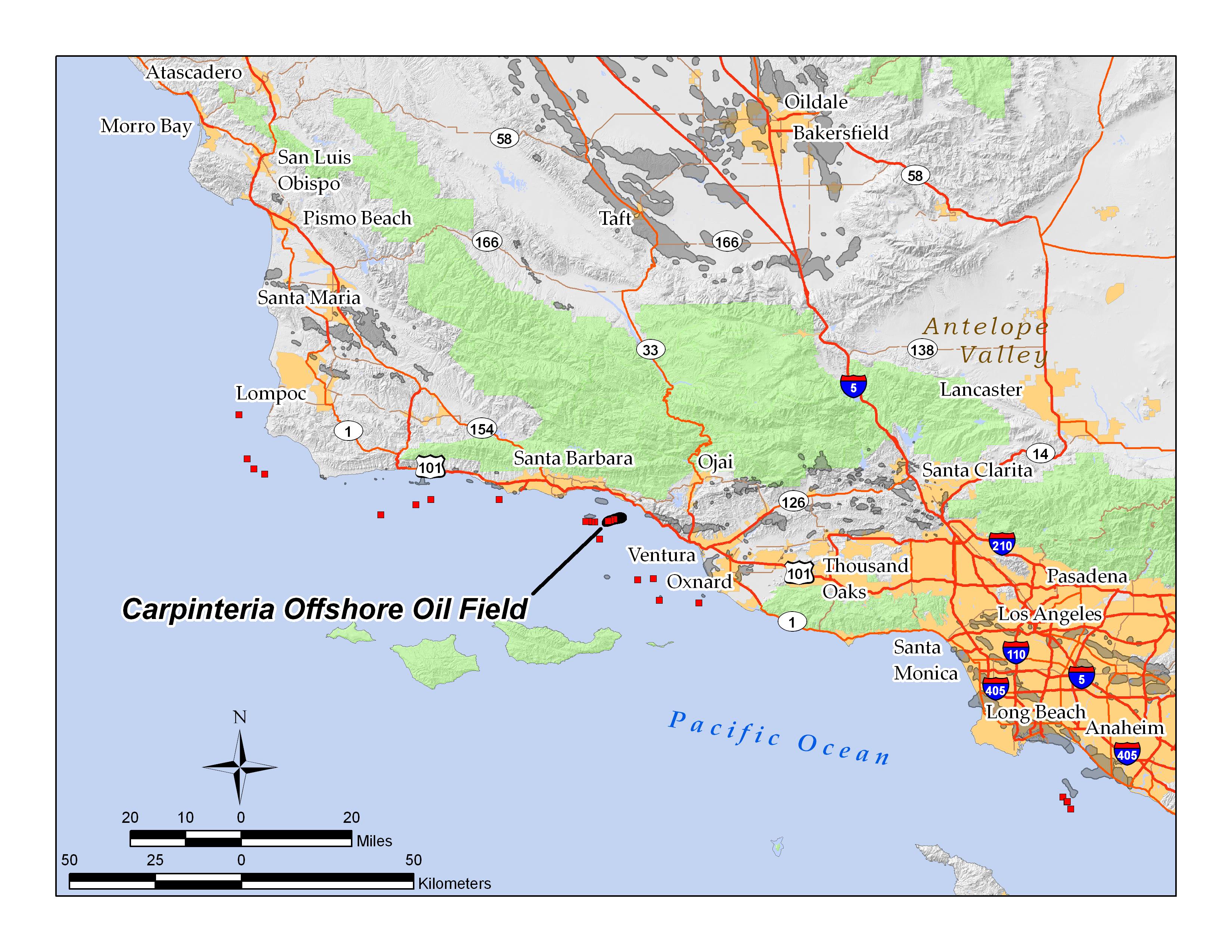
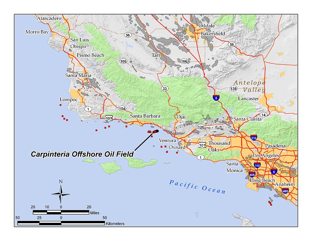
English:
Location map of the
Carpinteria Offshore Oil Field
— and other offshore
oil fields
(red squares) off coastal
Santa Barbara County
, California.
|
| Date | 7 August 2010 (original upload date) |
| Source | Transferred from en.wikipedia to Commons by Quadell using CommonsHelper . |
| Author | Antandrus at English Wikipedia |
Licensing
Antandrus
at
English Wikipedia
, the copyright holder of this work, hereby publishes it under the following licenses:
This file is licensed under the
Creative Commons
Attribution-Share Alike 3.0 Unported
license.
Attribution:
Antandrus
at
English Wikipedia
-
You are free:
- to share – to copy, distribute and transmit the work
- to remix – to adapt the work
-
Under the following conditions:
- attribution – You must give appropriate credit, provide a link to the license, and indicate if changes were made. You may do so in any reasonable manner, but not in any way that suggests the licensor endorses you or your use.
- share alike – If you remix, transform, or build upon the material, you must distribute your contributions under the same or compatible license as the original.

|
Permission is granted to copy, distribute and/or modify this document under the terms of the GNU Free Documentation License , Version 1.2 or any later version published by the Free Software Foundation ; with no Invariant Sections, no Front-Cover Texts, and no Back-Cover Texts. A copy of the license is included in the section entitled GNU Free Documentation License . |
You may select the license of your choice.
Original upload log
The original description page was
here
. All following user names refer to en.wikipedia.
- 2010-08-07 00:22 Antandrus 3300×2550× (1043417 bytes) Carpinteria oil field location map; by self in ArcGIS 9.3; all data displayed is in the public domain