Canadian_pop_from_1851_to_1921.jpg

Size of this preview:
421 × 599 pixels
.
Other resolutions:
169 × 240 pixels
|
337 × 480 pixels
|
540 × 768 pixels
|
720 × 1,024 pixels
|
2,130 × 3,030 pixels
.
Summary
| Description |
English:
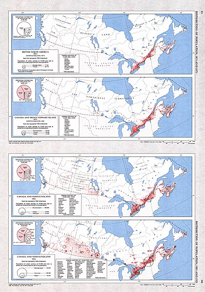
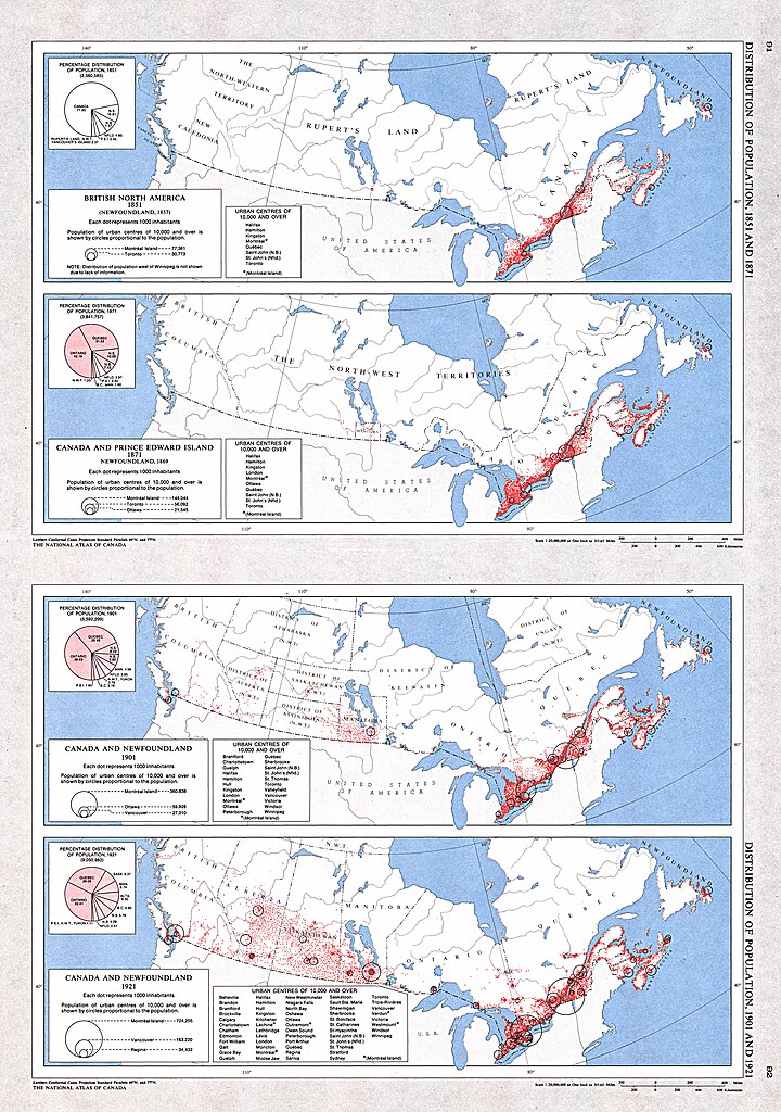
A collection of four maps showing the distribution of population for 1851 (Newfoundland 1857), 1871 (Newfoundland 1869), 1901 and 1921 by historical region. A supplementary chart for each map shows the percentage of population by province and territory. As well, for each map, a text listing urban centres with historical populations of 10 000 or more is provided.
|
| Date | |
| Source | The Atlas of Canada |
| Author | Natural Resources Canada |
|
Permission
( Reusing this file ) |
Copyright / Permission to Reproduce (GeoGratis) |
Licensing
This file is licensed under the
Creative Commons
Attribution 2.5 Generic
license.
-
You are free:
- to share – to copy, distribute and transmit the work
- to remix – to adapt the work
-
Under the following conditions:
- attribution – You must give appropriate credit, provide a link to the license, and indicate if changes were made. You may do so in any reasonable manner, but not in any way that suggests the licensor endorses you or your use.