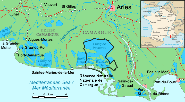
Camargue_map.png


Summary

Description
English: Map of the Camargue region, southern France
Date
Source Combination of CIA World Factbook map ( Image:Fr-map.png ) and Demis Map Server ( http://www2.demis.nl/mapserver/mapper.asp ) data with additional annotations and modifications by self.
Author ChrisO
Other versions

File:Camargue, Petite Caramgue et Parc naturel reg.png (relaunched and actualized)

Public domain
This image is in the public domain because it contains materials that originally came from the United States Central Intelligence Agency 's World Factbook .

Bahasa Indonesia čeština Deutsch eesti English español Esperanto français galego hrvatski italiano Nederlands norsk nynorsk polski português sicilianu slovenščina suomi Türkçe Zazaki беларуская (тарашкевіца) македонски русский српски / srpski українська ქართული বাংলা தமிழ் മലയാളം 한국어 日本語 中文 中文(简体) 中文(繁體) العربية +/−

Captions

Add a one-line explanation of what this file represents

Items portrayed in this file

depicts

16 August 2006

image/png

3ee618bf6e0482ef2c03521d24e5d9f2af742cbb

42,542 byte

396 pixel

718 pixel